Spálený (555 m a.s.l., Hřebeny)
Register and log summit

About peak Spálený
 Česko
Příbram (Středočeský kraj)
Logged on Vrcholovka 4x in total. Vrchol Spálený was added here by Martin Matějka and info was completed by Trailrunner, Martin Matějka a Mirek Voracek.
Spálený is part of challenges: Nejhory Brd a Hřebenů, The Highest Mountains of Central Bohemia
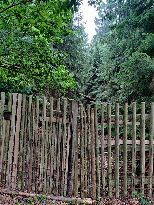
A peak in the inaccessible fenced game reserve Aglaia with black game.
- Chalet/accommodation
-
There is no chalet on the peak.
- Stroller access
-
Peak is not stroller accessible.
- Views
-
There are no views from the peak.
- Cable car
-
There is no cable car to this peak.
- Equipment
-
No special equipment is required for this summit.
- Accessibility
-
Aglaia Game Reserve. The nearest accessible point is about 300 m WSW, 35 meters lower in elevation. See photo - the path to the peak in the closed private reserve.
Nearest peaks: Malinová (507 m, 0.7 km) Obora (465 m, 1.5 km) Aglaia (491 m, 1.7 km) Bezový (471 m, 2.1 km) At the Shooting Range (400 m, 2.2 km) Kazatelna (531 m, 2.3 km) Stožec (605 m, 2.3 km) Hořejší Křemeny (464 m, 2.5 km) Nad Besídkou Z (411 m, 2.5 km) V Srškách (401 m, 2.5 km) Nad Besídkou (416 m, 2.7 km) Above the Black Stream (461 m, 2.8 km) Brdo (603 m, 2.9 km) Jistevník (606 m, 3 km) Větrník (419 m, 3.2 km) Na Větrníku (407 m, 3.4 km)

Sun
| today | tomorrow | day after tomorrow | |
|---|---|---|---|
| Dawn: | 6:09 | 6:11 | 6:12 |
| Sunrise: | 6:42 | 6:44 | 6:46 |
| Sunset: | 16:51 | 16:50 | 16:48 |
| Dusk: | 17:25 | 17:23 | 17:21 |