



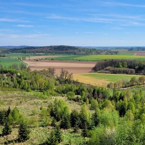

Hiking, 43 km
13.4.2024
 Česko
Třebíč (Kraj Vysočina)
Logged on Vrcholovka 4x in total. Vrchol Záhoří was added here by Bělka and info was completed by Jiřina a Martin Matějka.
The summit is not marked but is easily identifiable thanks to the "bunker" right at the top. It can be used as a shelter against rain, but it is in poor condition.
Unfortunately, the views are obstructed by the tall trees.
There is no chalet on the peak.
Peak is not stroller accessible.
There are no views from the peak.
There is no cable car to this peak.
No special equipment is required for this summit.
Accessible only on foot due to the rugged terrain.
Nearest peaks: Záhoří SV (566 m, 0.5 km) Klučovská hora (595 m, 0.7 km) Ovčárka (593 m, 1 km) Rohovec (554 m, 1.6 km) Hardeky (583 m, 1.8 km) U Horáku (549 m, 1.8 km) Nad silnicí (517 m, 2.1 km) Na močidlech (497 m, 2.6 km)
| today | tomorrow | day after tomorrow | |
|---|---|---|---|
| Dawn: | 6:00 | 6:01 | 6:03 |
| Sunrise: | 6:32 | 6:34 | 6:35 |
| Sunset: | 16:47 | 16:46 | 16:44 |
| Dusk: | 17:20 | 17:18 | 17:17 |



