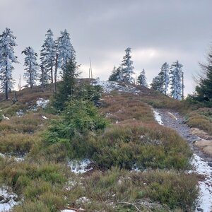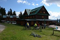
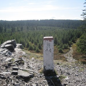

Hiking, 24 km
19.9.2025
 Česko
Šumperk (Olomoucký kraj)
Logged on Vrcholovka 29x in total. Peak information here was completed by krupjan, Martin Matějka a Jiří Králík.
Hřebeňák is part of challenges: Nejhory Rychleb, Thousanders of the Jeseníky
Most hiking maps, including Mapy.cz, place the summit of Hřebeňák about 500 m south of the summit of Trnová hora at the end of the sloping summit plateau with an elevation of 1026 m. However, this is only a resting point. The actual summit of Hřebeňák is not marked on these maps and is located about 400 m southwest of this resting point. /tisicovky.cz
There is no chalet on the peak.
Peak is not stroller accessible.
There are no views from the peak.
There is no cable car to this peak.
No special equipment is required for this summit.
Peak is freely accessible.
Nearest peaks: Trnová hora (1060 m, 0.8 km) Luční hora V (966 m, 1.3 km) Ostružník (940 m, 1.4 km) Liščí hora (1007 m, 1.5 km) Ostružník (952 m, 1.7 km) Travná hora (1125 m, 1.9 km) Palaš (1025 m, 2.1 km) Nad Bídou (858 m, 2.2 km) Stráž (835 m, 2.3 km) Kuník (1078 m, 2.6 km) Holý vrch (852 m, 2.7 km) Holý vrch Z (785 m, 2.7 km) Brousek (1116 m, 3 km) Above the Viaduct (715 m, 3.2 km) Bílé kameny (1029 m, 3.4 km) Smrk (1127 m, 3.6 km) Prostřední stráň (700 m, 3.9 km)
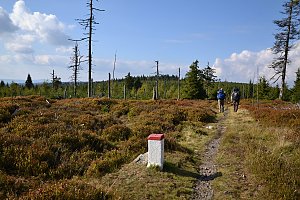 Via Czechia - Stezka Slezkem
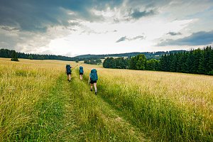
 Velké Vrbno: Hotel Paprsek
 Velké Vrbno: Hotel Paprsek
 Velké Vrbno: Snow park Paprsek
 Velke Vrbno: Snow park Paprsek - Nástup na lanovku
 Velke Vrbno: Snow park Paprsek - Kaplička
 Ostruzna: Ramzová
 Ostruzna: Skiarena R Ramzová - Horské minikáry
 Ramzová: Ski Center R3 Ramzova
 Ostruzna: Skiarena R Ramzová - Horní část sjezdovky Skiareálu Ramzová
 Branna u Sumperka: Ski areál Branná - Ski Branná - horní kamera
 Branna u Sumperka: Ski areál Branná - Výstup z lanovky

| today | tomorrow | day after tomorrow | |
|---|---|---|---|
| Dawn: | 5:58 | 6:00 | 6:01 |
| Sunrise: | 6:32 | 6:33 | 6:35 |
| Sunset: | 16:39 | 16:37 | 16:36 |
| Dusk: | 17:13 | 17:11 | 17:09 |