Mumlavská hora (1218 m a.s.l., Giant Mountains)
Register and log summit


About peak Mumlavská hora
 Česko
 Polsko
Semily (Liberecký kraj)
Logged on Vrcholovka 9x in total. Peak information here was completed by Martin Matějka a Bouřka.
Mumlavská hora is part of challenges: Nejhory Liberecka, Tisícovky Krkonoš
Also known as Žlabský vrch, Polish name Mumlawski Wierch, a secondary peak located 1650 m northwest of Luboch. Covered with sparse and damaged spruce forest. (tisicovky.cz)
- Chalet/accommodation
-
There is no chalet on the peak.
- Stroller access
-
Peak is not stroller accessible.
- Views
-
There are no views from the peak.
- Cable car
-
There is no cable car to this peak.
- Equipment
-
No special equipment is required for this summit.
- Accessibility
-
I. zone of the National Park.
Nearest peaks: Kamenec (1238 m, 1.3 km) Luboch (1296 m, 1.7 km) Owcze Skały (1041 m, 1.8 km) Przedzial (1068 m, 1.8 km) Skalna Brama (1018 m, 2.5 km) Babiniec (998 m, 2.7 km) Kocierz (928 m, 2.9 km)
Routes nearby
(elevation gain 2400 m, 71 km)
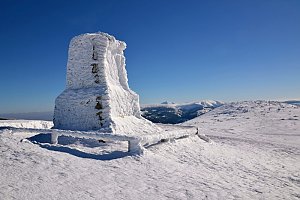 Labská stezka
(elevation gain 654 m, 1300 km)
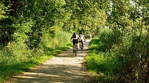
Mountain chalets
(876 m a.s.l., 3 km)
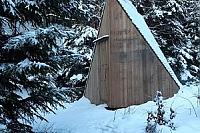
(1350 m a.s.l., 3.1 km)
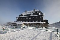
(1250 m a.s.l., 3.3 km)
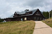
(967 m a.s.l., 3.9 km)
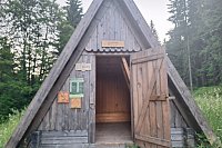
(975 m a.s.l., 5.4 km)

(1055 m a.s.l., 5.6 km)
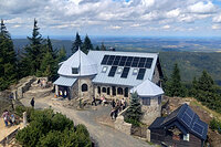
(1140 m a.s.l., 6.3 km)
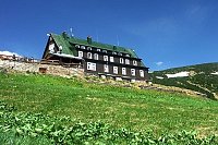
(1025 m a.s.l., 6.9 km)
Webcams
(1361 m a.s.l., 3.2 km)
 Szklarska Poręba › South-East: Szrenica - Karkonosze
(1319 m a.s.l., 3.2 km)
 Rokytnice nad Jizerou › South: Vosecká bouda
( 3.3 km)
 Szklarska Poręba › South-West: Vosecká bouda
(1251 m a.s.l., 3.3 km)
 Szklarska Poręba
(887 m a.s.l., 3.5 km)
 Szklarska Poreba Gorna › West: Polana Jakuszycka
( 3.5 km)
 Harrachov
(823 m a.s.l., 3.6 km)
 Harrachov: FIS Ski Jump Hills
(686 m a.s.l., 3.9 km)
 Marysin: Sudety Lift - Karkonosz Express
(720 m a.s.l., 4 km)
 Marysin: Sudety Lift -ski
(720 m a.s.l., 4 km)
 Ryzoviste: LANOVÁ DRAHA - CERTOVA HORA
( 4.2 km)
 Harrachov: Skokanské můstky
( 4.2 km)
 Harrachov: LANOVA DRAHA - CERTOVA HORA
( 4.2 km)
 Harrachov: POI 1
( 4.3 km)
 Harrachov: MAMUTI MUSTEK
( 4.4 km)
 Harrachov › North-east
( 4.7 km)
 Harrachov: ČERVENÁ II
( 4.8 km)
 Harrachov: CERTOVA HORA - VRCHOL
( 4.9 km)
 Harrachov: Alfa - Ski Areal
( 4.9 km)
 Harrachov: Cervena - Ski Areal
( 4.9 km)
 Harrachov: Cervena - Ski Areal
( 4.9 km)
 Ryzoviste: Ski Areal Harrachov
( 4.9 km)
 Harrachov: Cervena - Ski Areal
( 4.9 km)
 Harrachov: Cervena - Ski Areal
( 4.9 km)
 Harrachov: Certova Hora
( 5 km)
 Rokytnice nad Jizerou › South-West
(1093 m a.s.l., 5.5 km)
 Rokytno: Rokytnice n. Jizerou, Lysá hora
(1306 m a.s.l., 5.5 km)
 Rokytno: Lysá Hora
(1304 m a.s.l., 5.5 km)
 Rokytno: Lysá hora - Rokytnice
(1304 m a.s.l., 5.5 km)
 Rokytno: Lysá hora - Rokytnice
(1304 m a.s.l., 5.5 km)
 Szklarska Poręba: Rzeczpospolita - Dolina Szczęścia
(668 m a.s.l., 5.8 km)
 Rokytnice nad Jizerou › South-West
(750 m a.s.l., 6.3 km)
 Rokytno: Chata Světlanka
(870 m a.s.l., 6.6 km)
 Rokytnice nad Jizerou: II, POI 1
( 6.6 km)

Sun
| today | tomorrow | day after tomorrow | |
|---|---|---|---|
| Dawn: | 6:07 | 6:08 | 6:10 |
| Sunrise: | 6:41 | 6:42 | 6:44 |
| Sunset: | 16:42 | 16:40 | 16:38 |
| Dusk: | 17:16 | 17:14 | 17:13 |