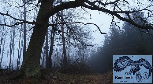



Hiking, 34 km
14.4.2024
 Česko
Třebíč (Kraj Vysočina)
Logged on Vrcholovka 4x in total. Vrchol Kání hora was added here by Jiřina and info was completed by Martin Matějka a Jiřina.
The summit is marked only by a sign and is located close to a forest path that somewhat leads nowhere (to a field).
There is no chalet on the peak.
This peak is accessible with a stroller.
There are views from the peak.
There is no cable car to this peak.
No special equipment is required for this summit.
Peak is freely accessible.
Nearest peaks: Kání hora JZ (564 m, 0.3 km) Pekelný (Pekelský) kopec (573 m, 1 km) Krochotě (551 m, 1.3 km) Na polodílech (484 m, 1.4 km) Mikulovická hora (586 m, 1.9 km) On the Hill SW (507 m, 1.9 km) Na Kopci (521 m, 2.2 km) U Hřiště (476 m, 2.4 km) Čichna (538 m, 2.5 km) At the Water Reservoir (482 m, 3.2 km) Vlčiny (557 m, 3.2 km) Šibený (514 m, 3.4 km) Borovina (466 m, 3.5 km)
| today | tomorrow | day after tomorrow | |
|---|---|---|---|
| Dawn: | 6:00 | 6:02 | 6:03 |
| Sunrise: | 6:33 | 6:34 | 6:36 |
| Sunset: | 16:48 | 16:46 | 16:44 |
| Dusk: | 17:20 | 17:19 | 17:17 |