Stinská (1093 m a.s.l., Bukovské vrchy)
Register and log summit

About peak Stinská
 Slovensko
Logged on Vrcholovka 2x in total. Peak information here was completed by Martin Matějka, Malek Belhadj a Daniel Ledl.
Stinská is part of challenge: Slovensko 200+
Help others and .
- Chalet/accommodation
-
There is no chalet on the peak.
- Stroller access
-
Peak is not stroller accessible.
- Views
-
There are no views from the peak.
- Cable car
-
There is no cable car to this peak.
- Equipment
-
No special equipment is required for this summit.
- Accessibility
-
The summit is not accessible as it is located within the protected area of NPR Stinská and there is no marked hiking trail leading to it.
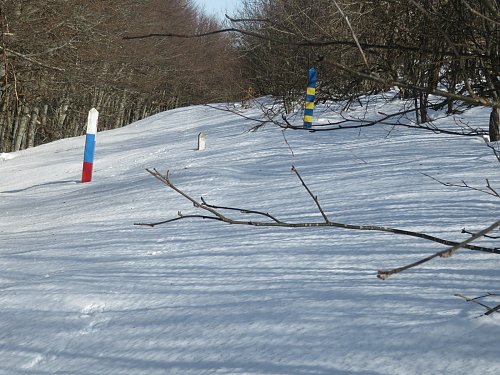
The peak is unmarked and lies between the Slovak-Ukrainian border markers.
The summit can be accessed from the Ukrainian side, provided you are not stopped by border guards (for example, due to suspicion of smuggling). The starting point can be the village of Kňahyňa, from where a blue-marked trail leads almost to the border and to the summit of Stinka (1019 m a.s.l.). Beyond that, the path is unmarked, but on the Ukrainian side, it is not in a protected landscape area. The route then leads to the border and the summit of Stinka and continues along the border line to this summit Stinská (1093 m a.s.l.)
Nearest peaks: Stinka (1066 m, 1.6 km)
Routes nearby
Routes provided by SvetOutdooru.cz
Sun
| today | tomorrow | day after tomorrow | |
|---|---|---|---|
| Dawn: | 6:33 | 6:35 | 6:36 |
| Sunrise: | 7:06 | 7:07 | 7:09 |
| Sunset: | 17:21 | 17:20 | 17:18 |
| Dusk: | 17:54 | 17:52 | 17:51 |