Hiking, 18 km
19.3.2024
 Švédsko
Logged on Vrcholovka 5x in total. Vrchol Kebnekaise Sydtoppen was added here by Milan "Hojší" Průžek and info was completed by Martin Matějka.
Kebnekaise (from Northern Sami Giebmegáisi or in a more modern form Giebnegáisi, "ridge of the kettle") is the highest mountain in Sweden. The Kebnekaise massif, part of the Scandinavian Mountains, has two peaks. The glaciated southern peak was higher at 2120 m above sea level, but has shrunk by 24 meters over the last 50 years, making the northern peak, without ice, at an elevation of 2096.8 m, the taller one. Kebnekaise is located in Swedish Lapland, in Norrbotten County, about 150 km north of the Arctic Circle and west of Kiruna, near the long-distance hiking trail Kungsleden, which connects Abisko and Hemavan.
From the summit, an area of 40,000 km² is visible, including part of neighboring Norway.
Access
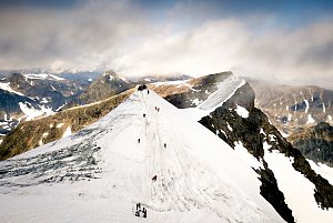
The summit of Kebnekaise is quite far from civilization, and the ascent is therefore a 2-3 day hike. At the foot of Kebnekaise, about 19 km (6-7 hours) from the village of Nikkaluokta, is the Kebnekaise fjällstation mountain lodge. This is the starting point for the ascent via the western route (an additional 13 km, 4-6 hours to the summit) or the eastern route (an additional 10 km, 3-5 hours to the summit). The western route leads over rocky slopes to the sub-peak Vierranvárri and then to the glaciated southern peak itself. The eastern route over glaciers and rocks is secured with a steel cable, similar to a via ferrata.
There is no chalet on the peak.
Peak is not stroller accessible.
There are views from the peak.
There is no cable car to this peak.
Special equipment is required for this summit.
Peak is freely accessible.
Nearest peaks: Kebnekaise (2097 m, 0.7 km) Vierranvárri (1706 m, 2.2 km)
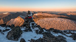 Výstup na královnu švédských hor - Kebnekaise
| today | tomorrow | day after tomorrow | |
|---|---|---|---|
| Dawn: | 7:05 | 7:08 | 7:12 |
| Sunrise: | 8:12 | 8:17 | 8:21 |
| Sunset: | 14:46 | 14:42 | 14:37 |
| Dusk: | 15:53 | 15:50 | 15:47 |