


Hiking, 12 km
5.11.2026


Logged on Vrcholovka 1x in total. Spočinek Local forest J was added here by Daniel Bača.
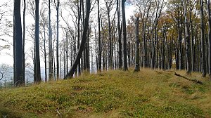
A very flat peak in a field, separated from the higher northern peak by a very shallow saddle.
There is no chalet on the peak.
This peak is accessible with a stroller.
There are views from the peak.
There is no cable car to this peak.
No special equipment is required for this summit.
Peak is freely accessible.
Nearest peaks: Místecký les (345 m, 0.5 km) Rusinec (336 m, 0.9 km) Na Hlínách (360 m, 1.1 km) Na Horách SV (435 m, 1.9 km) Hůrky (417 m, 2.3 km) Na Horách (453 m, 2.3 km) In the Mountains V (457 m, 2.4 km) Čupek (524 m, 2.9 km) U Kříže (324 m, 3 km) Nad Metylovicemi (414 m, 3.4 km) Lysůvky (355 m, 3.6 km) Na Magoni (497 m, 3.6 km)
 Přechod hlavního hřebene Moravskoslezských Beskyd
| today | tomorrow | day after tomorrow | |
|---|---|---|---|
| Dawn: | 6:09 | 6:11 | 6:12 |
| Sunrise: | 6:43 | 6:45 | 6:46 |
| Sunset: | 16:16 | 16:15 | 16:13 |
| Dusk: | 16:50 | 16:49 | 16:48 |
