Roc d'Enfer (2244 m a.s.l., Chablais-Faucigny)
Register and log summit
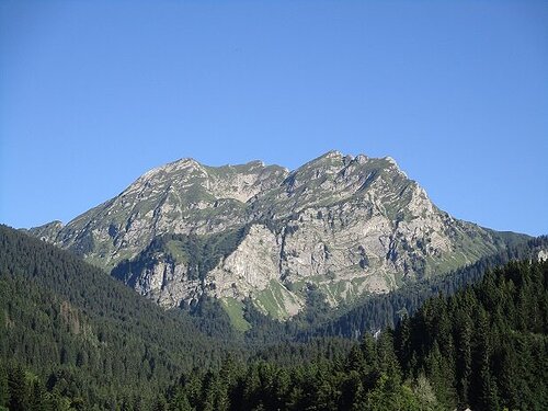

About peak Roc d'Enfer
 Francie
Vrchol Roc d'Enfer was added here by Tomáš Bublan.
Help others and .
- Chalet/accommodation
-
There is no chalet on the peak.
- Stroller access
-
Peak is not stroller accessible.
- Views
-
There are views from the peak.
- Cable car
-
There is no cable car to this peak.
- Equipment
- Accessibility
-
Peak is freely accessible.
Routes nearby
Výstup na vrchol Dent de Verreu přes feratu de la Mont
(elevation gain 1200 m, 12 km)
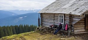 Trek ve Fer-a-Cheval aneb Kamzičí roh, vodopády a „indické“ jezero
(elevation gain 1500 m, 13 km)

Routes provided by SvetOutdooru.cz
(elevation gain 1200 m, 12 km)
Trek ve Fer-a-Cheval aneb Kamzičí roh, vodopády a „indické“ jezero(elevation gain 1500 m, 13 km)
Webcams
Saint-Jean-d'Aulps
(416 m a.s.l., 2.5 km)
 Saint-Jean-d'Aulps
(415 m a.s.l., 3.2 km)
 Les Gets: Sommet Mont-Chéry
(1805 m a.s.l., 3.6 km)
 Les Gets › South-east: Mont Blanc
( 3.8 km)
 Les Gets
(425 m a.s.l., 4.5 km)
 Les Gets › North-west: Mont Chéry
( 4.6 km)
 Taninges › North-east: Le Praz de Lys
( 4.9 km)
 Taninges › South-east: Mont Maudit
( 5.2 km)
 Taninges › South-east: Pointe de Véran
( 5.3 km)
 Mieussy › East: Plateau de Sommand
( 5.3 km)
 Taninges › South-east: Mont Blanc
( 5.4 km)
 Les Gets: Route des Metrallins
( 5.6 km)
 Les Gets: Route du Front de Neige
( 5.8 km)
 Les Gets: Télésiège des Perrières
( 5.8 km)
 Taninges: Praz De Lys Sommand
(1948 m a.s.l., 5.8 km)
 Mieussy
( 5.8 km)
 Mieussy › South-east: Pointe du Haut Fleury
( 5.9 km)

Cameras provided by windy.com
(416 m a.s.l., 2.5 km)
Saint-Jean-d'Aulps(415 m a.s.l., 3.2 km)
Les Gets: Sommet Mont-Chéry(1805 m a.s.l., 3.6 km)
Les Gets › South-east: Mont Blanc( 3.8 km)
Les Gets(425 m a.s.l., 4.5 km)
Les Gets › North-west: Mont Chéry( 4.6 km)
Taninges › North-east: Le Praz de Lys( 4.9 km)
Taninges › South-east: Mont Maudit( 5.2 km)
Taninges › South-east: Pointe de Véran( 5.3 km)
Mieussy › East: Plateau de Sommand( 5.3 km)
Taninges › South-east: Mont Blanc( 5.4 km)
Les Gets: Route des Metrallins( 5.6 km)
Les Gets: Route du Front de Neige( 5.8 km)
Les Gets: Télésiège des Perrières( 5.8 km)
Taninges: Praz De Lys Sommand(1948 m a.s.l., 5.8 km)
Mieussy( 5.8 km)
Mieussy › South-east: Pointe du Haut Fleury( 5.9 km)
Sun
| today | tomorrow | day after tomorrow | |
|---|---|---|---|
| Dawn: | 6:33 | 6:35 | 6:36 |
| Sunrise: | 7:04 | 7:05 | 7:07 |
| Sunset: | 17:30 | 17:29 | 17:27 |
| Dusk: | 18:01 | 17:59 | 17:58 |