



Running, 46 km
17.10.2026
 Česko
 Polsko
Jeseník (Olomoucký kraj)
Logged on Vrcholovka 42x in total. Vrchol Hraničný vrch was added here by Šárka and info was completed by Martin Matějka.
Hraničný vrch (752 m) is located directly on the state border with Poland in the Rychlebské Mountains and is marked by a border stone with the sign III/28. The state border in this area runs through undulating terrain with descents and ascents. The Rychlebské Mountains are among the least visited yet most beautiful corners of our country. A minimum of tourists and beautiful, wild nature.
There is no chalet on the peak.
Peak is not stroller accessible.
There are views from the peak.
There is no cable car to this peak.
No special equipment is required for this summit.
Peak is freely accessible.
Nearest peaks: Malá Enkláva (761 m, 0.6 km) Malá Roveň (744 m, 0.8 km) Roveň (778 m, 1 km) Enclave (790 m, 1.2 km) Vábný (637 m, 1.3 km) Strážiště (813 m, 1.6 km) Černý vrch (832 m, 1.7 km) Plesnivý vrch (790 m, 1.9 km) Pod Černým vrchem (748 m, 2.3 km) Hřeben (659 m, 2.6 km) Zadní Silniční vrch (622 m, 2.8 km) Silniční vrch (640 m, 3.2 km) Koníček (851 m, 3.6 km) Gologrzbiet (943 m, 3.9 km)
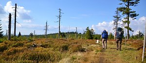 Přechod Rychlebských hor
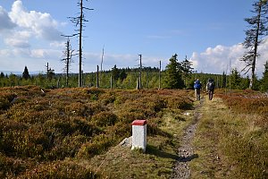 Via Czechia - Stezka Slezkem
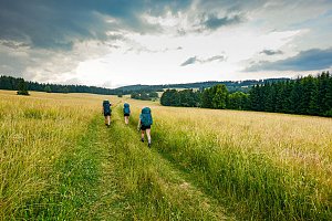
| today | tomorrow | day after tomorrow | |
|---|---|---|---|
| Dawn: | 6:55 | 5:57 | 5:59 |
| Sunrise: | 7:29 | 6:30 | 6:32 |
| Sunset: | 17:43 | 16:41 | 16:39 |
| Dusk: | 18:16 | 17:14 | 17:13 |