
Hiking, 8 km
8.5.2026
 Česko
Bruntál (Moravskoslezský kraj)
Logged on Vrcholovka 18x in total. Vrchol Jelení vrch was added here by Mountainer and info was completed by Mountainer.
Jelení vrch is part of challenges: Menagerie, Nejhory Moravskoslezska, Ultrakopce
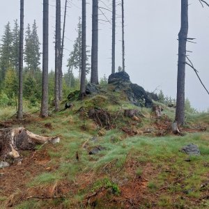
Just barely the second highest peak of the Holčovická Highlands (after the nearby one-meter taller Jedlová) separating the valleys of Opavice and Černá Opava. Near the summit, we find several small bunkers of the pre-war border fortifications (so-called "řopíky"). A yellow hiking trail runs over the summit, connecting Heřmanovice with the blue hiking trail from Holčovice to Vrbno pod Pradědem. The peak is quite densely forested, thus lacking any views. South of the summit is the rock group Sokolí skály.
There is no chalet on the peak.
Peak is not stroller accessible.
The summit is forested, and therefore lacks views.
There is no cable car to this peak.
No special equipment is required for this summit.
Peak is freely accessible.
Nearest peaks: Tisová (866 m, 0.8 km) Sokolí skály (846 m, 0.9 km) Marie (855 m, 1.1 km) Malý Mlýnský vrch (665 m, 1.4 km) Jedlová (874 m, 1.5 km) Rokytník (819 m, 1.6 km) Skála u polomu (853 m, 1.9 km) Velký polom (857 m, 1.9 km) Mlýnský vrch (728 m, 2.1 km) Ostrý (819 m, 2.1 km) Větrník (843 m, 2.1 km) Ostrý V (790 m, 2.4 km) Horka (866 m, 2.5 km) Malý Špičák (758 m, 2.5 km) Špičák (763 m, 2.6 km) Čihadlo (744 m, 2.8 km) Huk (788 m, 3.1 km)
 Andelska Hora ve Slezsku: Annaberg - Modrá sjezdovka
 Andelska Hora ve Slezsku: Annaberg - Červená sjezdovka
 Andelska Hora ve Slezsku: Annaberg - Modrá sjezdovka, vlek
 Zlate Hory › North
 Andelska Hora ve Slezsku: Annaberg - Anenský vrch
 Andelska Hora ve Slezsku: Annaberg - Sjezdovka
 Zlate Hory

| today | tomorrow | day after tomorrow | |
|---|---|---|---|
| Dawn: | 5:57 | 5:58 | 6:00 |
| Sunrise: | 6:30 | 6:32 | 6:33 |
| Sunset: | 16:38 | 16:36 | 16:34 |
| Dusk: | 17:11 | 17:09 | 17:08 |