Vernadais (2367 m a.s.l., Marmolada)
Register and log summit
Weather Vernadais

About peak Vernadais
 Itálie
Vrchol Vernadais was added here by Jan Blažej.
Help others and .
- Chalet/accommodation
-
There is no chalet on the peak.
- Stroller access
-
Peak is not stroller accessible.
- Views
-
There are views from the peak.
- Cable car
-
There is no cable car to this peak.
- Equipment
-
No special equipment is required for this summit.
- Accessibility
-
Peak is freely accessible.
Nearest peaks: Col Ombert (2670 m, 0.6 km) Cima Cadine (2885 m, 1.9 km) Cima dell'Uomo (3010 m, 2 km) Ponta del Ciadin (2922 m, 2 km) Punta de le Valate (2837 m, 2 km) Om Gran (2805 m, 2.2 km) Colac (2715 m, 2.3 km) Castello di Costabella (2730 m, 2.4 km) Cima di Costabella (2765 m, 2.7 km) Cima de Campagnacia (2737 m, 3.2 km)
Routes nearby
(elevation gain 10000 m, 105 km)
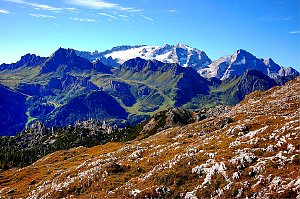 Výstup na Cima Ombretta
(elevation gain 1700 m, 20 km)
 Výstup na Punta Serauta feratou Eterna – Brigata Cadore
(elevation gain 1800 m, 7 km)
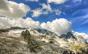 Marmolada - výstup na nejvyšší vrchol Dolomit
(elevation gain 1400 m, 9 km)
Feratová túra hřebenem Padon v Dolomitech(elevation gain 1500 m, 10 km)
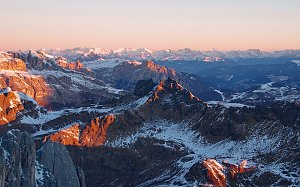 Výstup na Piz Boe - nejlehčí třítisícovku v Dolomitech
(elevation gain 1000 m, 10 km)
Webcams
(-32768 m a.s.l., 1.4 km)
 Soraga di Fassa
( 2.8 km)
 Soraga di Fassa
( 3.5 km)
 Moena: Val di Fassa - Cima Uomo
( 3.5 km)
 Canazei: Funivia Ciampac - Colac - Gran Vernel
(1530 m a.s.l., 3.8 km)
 Canazei: Colac
(1530 m a.s.l., 3.8 km)
 Canazei: Marmolada - Fedaia Lake - Passo Fedaia
(1506 m a.s.l., 4.3 km)
 Soraga di Fassa
(2022 m a.s.l., 4.3 km)
 Soraga di Fassa
(2007 m a.s.l., 4.3 km)
 Soraga di Fassa
(2007 m a.s.l., 4.3 km)
 Soraga di Fassa
(2007 m a.s.l., 4.3 km)
 Moena: San Pellegrino Pass
(1969 m a.s.l., 4.6 km)
 Moena: San Pellegrino Pass - Col Margherita - Cima Bocche
(1969 m a.s.l., 4.6 km)
 San Pellegrino: Cima Uomo - Marmolada
(1910 m a.s.l., 5 km)
 Moena
( 5.1 km)
 Ciamp del Pezzo: Passo San Pellegrino − Cima Uomo
(1917 m a.s.l., 5.1 km)
 Vigo di Fassa: Passo Fedaia - Fedaia Lake - Marmolada - Ciampedie - Vigo Di Fassa - Rosengarten Group - Gran Vernel
(2348 m a.s.l., 5.7 km)
 Moena
(2064 m a.s.l., 5.9 km)
 Livinallongo del Col di Lana: Pordoi - Pass
(2366 m a.s.l., 6.2 km)
 Moena: San Pellegrino - Col Margherita
( 6.2 km)
 Moena: San Pellegrino - Col Margherita
( 6.2 km)
 Moena: Lago di Cavia
(2485 m a.s.l., 6.3 km)
 Moena: Monte Civetta
(2503 m a.s.l., 6.3 km)
 San Pellegrino: Col Margherita
(2503 m a.s.l., 6.3 km)
 Canazei
(1450 m a.s.l., 6.3 km)
 Canazei
(1455 m a.s.l., 6.4 km)
 Moena: Funivia Col Margherita Spa
(2461 m a.s.l., 6.4 km)
 Campitello di Fassa
( 7.2 km)
 Campitello di Fassa › North-west: pizzeria camping Miravalle (La Stua De Tate)
( 7.2 km)

Sun
| today | tomorrow | day after tomorrow | |
|---|---|---|---|
| Dawn: | 7:10 | 7:11 | 6:13 |
| Sunrise: | 7:41 | 7:42 | 6:44 |
| Sunset: | 18:12 | 18:11 | 17:09 |
| Dusk: | 18:43 | 18:41 | 17:40 |