Hörnle (910 m a.s.l., Allgäuské Alpy)
Register and log summit

About peak Hörnle
 Německo
Vrchol Hörnle was added here by PetanOP.
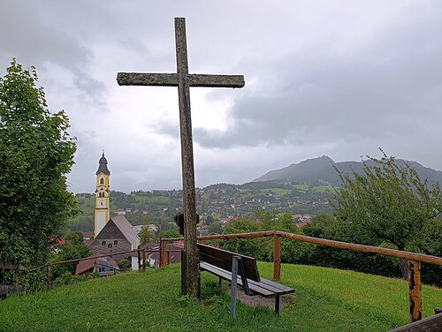
An easy peak above the town with a cross and fantastic views, with an interesting St. Nicholas church below the summit.
- Chalet/accommodation
- Stroller access
-
Peak is not stroller accessible.
- Views
-
There are views from the peak.
- Cable car
-
There is no cable car to this peak.
- Equipment
-
No special equipment is required for this summit.
- Accessibility
-
Peak is freely accessible.
Routes nearby
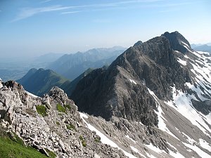
Výstup na Tegelberg a Branderschrofen
(elevation gain 1400 m, 12 km)
 Hřebenovka Allgäuerských Alp po zajištěných cestách Jubiläumsweg a Heilbronner Weg
(elevation gain 2900 m, 45 km)
Routes provided by SvetOutdooru.cz
(elevation gain 1400 m, 12 km)
Hřebenovka Allgäuerských Alp po zajištěných cestách Jubiläumsweg a Heilbronner Weg (elevation gain 2900 m, 45 km)
Webcams
Meilingen: Pfronten, Eiscafe Bolina Livecam und Wetterstation
(835 m a.s.l., 0.8 km)
 Meilingen: Pfronten - Alpenbad
(888 m a.s.l., 1.3 km)
 Pfronten › South
(868 m a.s.l., 2.3 km)
 Benkendorf: Pfronten:Der Blick vom Burghotel Falkenstein ins Pfrontner Tal
(1241 m a.s.l., 3.3 km)
 Eisenberg: Burgruine
( 3.9 km)
 Pfronten
(1808 m a.s.l., 4.1 km)
 Nesselwang: Alpspitzbahn Sportheim Böck
( 4.2 km)
 Pfronten: Breitenbergbahn
(1653 m a.s.l., 4.5 km)
 Nesselwang: Alpspitzbahn Mittelstation
( 4.9 km)
 Nesselwang: Alpspitzbahn Talstation
( 5.7 km)

Cameras provided by windy.com
(835 m a.s.l., 0.8 km)
Meilingen: Pfronten - Alpenbad(888 m a.s.l., 1.3 km)
Pfronten › South(868 m a.s.l., 2.3 km)
Benkendorf: Pfronten:Der Blick vom Burghotel Falkenstein ins Pfrontner Tal(1241 m a.s.l., 3.3 km)
Eisenberg: Burgruine( 3.9 km)
Pfronten(1808 m a.s.l., 4.1 km)
Nesselwang: Alpspitzbahn Sportheim Böck( 4.2 km)
Pfronten: Breitenbergbahn(1653 m a.s.l., 4.5 km)
Nesselwang: Alpspitzbahn Mittelstation( 4.9 km)
Nesselwang: Alpspitzbahn Talstation( 5.7 km)
Sun
| today | tomorrow | day after tomorrow | |
|---|---|---|---|
| Dawn: | 6:22 | 6:23 | 6:25 |
| Sunrise: | 6:54 | 6:55 | 6:57 |
| Sunset: | 17:09 | 17:07 | 17:05 |
| Dusk: | 17:40 | 17:39 | 17:37 |