
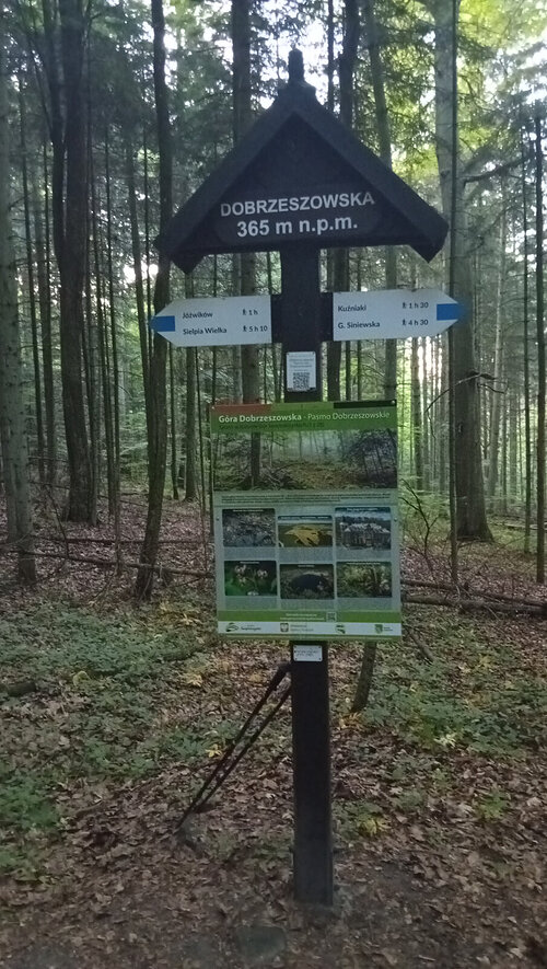



Hiking, 12 km
20.6.2026
 Polsko
Logged on Vrcholovka 1x in total. Vrchol Dobrzeszowska was added here by Milda and info was completed by Martin Matějka a Milda.
The highest peak of the Dobrzeszów Mountains, the westernmost part of the main Świętokrzyskie Mountains. It is separated from the Oblęgór Mountains by the gorge of the Łosośna River. It is composed of Triassic rocks and covered with a mixed forest of birch, beech, hornbeam, plane tree, and fir. Many trees are over 100 years old.
In the early Middle Ages, in pre-Christian times, an ancient temple functioned at the top of Dobrzeszowska. Today, due to a lack of historical sources, we are unable to determine its builder. In 2004, the journal “Etnografia Polska” published an article by Jarosław Kolczyński about the Dobrzeszów sanctuary with the telling title “Searching for the Symbolism of Emptiness, Darkness, and Silence.” In the mid-1970s, a group of archaeologists led by Eligia Gąssowska worked here. They discovered, among other things, that the flattened peak of “Dobrzeszowska” is surrounded by three stone ramparts. The highest of them is shaped like a closed ellipse measuring 100x25 m. The first elliptical rampart is followed by two adjoining ramparts in the shape of a crescent, thus creating a closed unit. The current height of the ramparts is 1.3 to 1.9 m and the width is up to 3 m. Originally, they were higher and steeper, but over time they have been naturally eroded. The circumference of the first rampart is 262.5 m, the second 260 m, and the third 332 m. From the west, the steepest access was from the foot of the hill into the interior of the circles via stone steps. Approximately in the middle of the circles, a large round boulder, considered the “central stone,” was discovered, along with a stone base, likely for an altar. To the east, at the height of the “central stone,” gaps were found in the outer ramparts. A thick layer of burnt material (up to 3 meters) was also discovered, indicating that large fires had been lit here for decades. Analysis of the burnt material using radiocarbon-14 allows us to estimate the date of its construction to the 8th century. Above the fire pits stood a large (approximately 1.8 meters high) menhir, which is currently toppled. Oval stelae and flat, round stones were also found, which may have marked the boundaries of the temple. On the western side, outside the ramparts, a flattened stone was found, which could have been an altar stone. Apart from a few small pieces of Roman pottery, no other traces of human presence were found at this site. This is the extent of the research; the rest, due to a lack of any sources, are conjectures and hypotheses. The lack of evidence of human presence inside the temple may suggest that access to it was very limited and those who crossed the ramparts had to proceed with great caution. They were likely not allowed to disturb the perfect emptiness, purity, and tranquility of this place. No sacrifices were likely brought inside (no bones remained), and if they were, they were carefully cleaned. Cracks in the eastern ramparts form a line that marks the path of the rising sun around May 1st. Therefore, fires could have been lit on the night of April 30th to May 1st, similar to the Celtic festival of Beltane. During this festival, druids reportedly used sun rays to ignite large fires. The night belonged to the supernatural; the spirits of ancestors and demons came from the afterlife, approaching each other and transitioning from the world of the dead to the world of the living. People did not leave their homes unless absolutely necessary. This was done only to ask their ancestors about their fate. During the day, people gathered around ritual fires and lit new fires that were to smolder in their homes throughout the year. Beltane marked the beginning of the better half of the year with a warm period, accompanied by the fertility of the soil and animals.
In 1982, a reserve “Góra Dobrzeszowska” was declared around the peak of Dobrzeszowska, covering an area of 25.11 hectares. It protected fragments of the Świętokrzyskie forests, including the forest ecosystem of oak-hornbeam forests with a rich diversity of flora and fauna, a prehistoric archaeological site of extraordinary value that has been preserved at the top of Dobrzeszowska, as well as remnants of human exploitation and production from historical times, primarily millstones and quarry stones.
The blue tourist trail of Stanisław Malanowicz runs through the peak of Dobrzeszowska from Skarżysko-Kamienna (the administrative settlement of Pogorzałe) to Kuźniaki.
There is no chalet on the peak.
Peak is not stroller accessible.
There are no views from the peak.
There is no cable car to this peak.
No special equipment is required for this summit.
Peak is freely accessible.
| today | tomorrow | day after tomorrow | |
|---|---|---|---|
| Dawn: | 5:49 | 5:51 | 5:53 |
| Sunrise: | 6:24 | 6:25 | 6:27 |
| Sunset: | 16:21 | 16:19 | 16:17 |
| Dusk: | 16:55 | 16:53 | 16:51 |
