



Hiking, 24 km
27.3.2026
 Německo
Logged on Vrcholovka 1x in total. Vrchol Hoher Hahn was added here by Nojby.
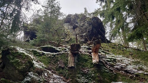
The highest point is a rock in the forest 100 m SSW from the point on the map.
Sonnenhotel Hoher Hahn
Peak is not stroller accessible.
There is no view from the rock; the viewpoint is located near the point on the map.
There is no cable car to this peak.
No special equipment is required for this summit.
Peak is freely accessible.
Nearest peaks: Hohe Henne (732 m, 1 km) Hirschenstein (639 m, 1.3 km) Rockelmann (581 m, 1.3 km) Becherberg (549 m, 1.7 km) Galgenberg (558 m, 2.1 km) Galgenberg Z (602 m, 2.1 km) Magnetenberg (686 m, 2.3 km) Magnetenberg (755 m, 2.7 km) Hasenhübel (549 m, 3.1 km)
 Breitenbrunn
 Breitenbrunn › South
 Grunhain-Beierfeld

| today | tomorrow | day after tomorrow | |
|---|---|---|---|
| Dawn: | 6:16 | 6:17 | 6:19 |
| Sunrise: | 6:49 | 6:51 | 6:53 |
| Sunset: | 16:55 | 16:54 | 16:52 |
| Dusk: | 17:29 | 17:27 | 17:26 |
