


Hiking
čt, 1.1.2026, 13:25
 Maďarsko
Logged on Vrcholovka 1x in total. Vrchol Hármashatár-hegy was added here by Jiří Králík and info was completed by Jiří Králík.
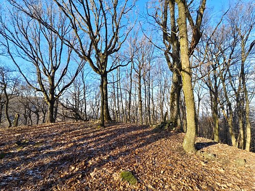
Summit off the trail. Take it directly along the ridge and beautifully avoid the forest enclosure.
There is no chalet on the peak.
Peak is not stroller accessible.
There are no views from the peak.
There is no cable car to this peak.
No special equipment is required for this summit.
Peak is freely accessible.
Nearest peaks: Kis Hármashatár-hegy (644 m, 0.6 km) Markazi-hegy (711 m, 0.7 km) Nagy-Szár-hegy (745 m, 0.7 km) Marhád (613 m, 0.9 km) Kis Markazi-hegy (663 m, 1 km) Kis-Sas-kő (830 m, 1.4 km) Cserepes-tető (741 m, 1.6 km) Sás-hegy (886 m, 1.7 km) Sas-kő (891 m, 2 km) Selyem (581 m, 2.3 km) Vörös-Tehén-nyak (488 m, 2.4 km) Éva-kő (629 m, 2.5 km) Oroszlánvár (604 m, 2.7 km) Szállás-hegy (657 m, 2.7 km) Hegyes-tető (632 m, 2.8 km) Pál-Bükk (476 m, 3.1 km) Rák-halom (481 m, 3.5 km)
| today | tomorrow | day after tomorrow | |
|---|---|---|---|
| Dawn: | 6:39 | 6:40 | 5:42 |
| Sunrise: | 7:10 | 7:12 | 6:13 |
| Sunset: | 17:37 | 17:35 | 16:33 |
| Dusk: | 18:09 | 18:07 | 17:05 |