


Hiking, 23 km
1.2.2026
 Česko
Šumperk (Olomoucký kraj)
Logged on Vrcholovka 2x in total. Spočinek Velká Stolová was added here by Jiří Králík.
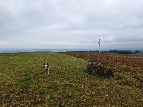
Views of Mohelnice and the surrounding area to the east. Contours are incorrectly marked on the map.
There is no chalet on the peak.
Peak is not stroller accessible.
There are views from the peak.
There is no cable car to this peak.
No special equipment is required for this summit.
Peak is freely accessible.
Nearest peaks: Nad Stolovou (464 m, 0.9 km) Vraní kopec (465 m, 1.4 km) Obecňák (406 m, 1.6 km) Mezi lesy (361 m, 1.8 km) Mezi lesy V (364 m, 1.8 km) Vyšehorský vrch (563 m, 1.9 km) Ostrý kopec (381 m, 2 km) Behind the Cemetery (348 m, 2.1 km) Vyšehorský kopec (564 m, 2.1 km) Hrad Mírov (415 m, 2.2 km) Malá Kamenná (377 m, 2.2 km) Míroveček (396 m, 2.3 km) Nad Kamennou (566 m, 2.4 km) Kamenná (391 m, 2.5 km) Malý Míroveček (394 m, 2.6 km) Nad Jánskou loukou (400 m, 2.7 km) Studničná (483 m, 2.8 km) Malá strážná hora (475 m, 2.9 km) Hrušky (377 m, 3.1 km) Strážná hora (482 m, 3.1 km) Under the Swedish Path (469 m, 3.3 km) Obora (480 m, 3.4 km)
| today | tomorrow | day after tomorrow | |
|---|---|---|---|
| Dawn: | 6:06 | 6:08 | 6:09 |
| Sunrise: | 6:40 | 6:41 | 6:43 |
| Sunset: | 16:32 | 16:30 | 16:28 |
| Dusk: | 17:05 | 17:04 | 17:02 |


