Oberfrauenwald (945 m a.s.l., Wegscheider Hochfläche)
Register and log summit

About peak Oberfrauenwald
 Německo
Vrchol Oberfrauenwald was added here by Martin Matějka.
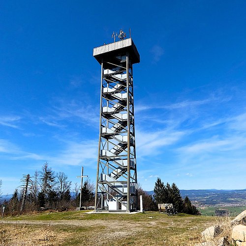
The highest peak of the German mountain range Wegscheider Hochfläche. At the summit, there is a nice lookout tower with excellent panoramic views.
- Chalet/accommodation
-
There is no chalet on the peak.
- Stroller access
-
This peak is accessible with a stroller.
- Views
-
There are views from the peak.
- Cable car
-
ski lift
- Equipment
-
No special equipment is required for this summit.
- Accessibility
-
Peak is freely accessible.
Webcams
Cameras provided by windy.com
Sun
| today | tomorrow | day after tomorrow | |
|---|---|---|---|
| Dawn: | 6:08 | 6:10 | 6:11 |
| Sunrise: | 6:40 | 6:42 | 6:44 |
| Sunset: | 16:57 | 16:56 | 16:54 |
| Dusk: | 17:30 | 17:28 | 17:26 |