
Hiking, 17 km
8.9.2026
 Česko
Chomutov (Ústecký kraj)
Logged on Vrcholovka 72x in total. Vrchol Jelení hora was added here by Vladimír Grančay and info was completed by Nojby a Martin Matějka.
Jelení hora is part of challenges: Cross on the Summit of Domestic Mountains and Hills, Czech Volcanoes, Highest Peaks of the Ore Mountains, Menagerie, Most Isolated, Nejhory Ústecka, Ultrakopce, Via Czechia Severní stezka
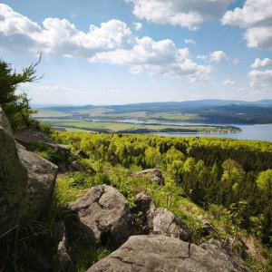
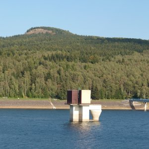
A prominent mountain above the Přísečnice reservoir, the highest peak of the Přísečnická hornatina region. Excellent views to the west of the summit, including the Přísečnice reservoir. The often cited height of 994 m is the height of a geodetic point (993.71 m), formed by a concrete stone pillar, rising quite high above the terrain. The height of the natural terrain is therefore 993 m. The mountain is a remnant of a neovolcanic lava cover with a gently sloping summit plateau and steep slopes. Nepheline emerges at the summit area associated with the main magma supply conduit. A second rock outcrop is located about 250 meters northwest of the summit and takes the form of a short vein measuring 5×30 meters, which was likely a secondary magma supply conduit. Columnar jointing of the rock is evident at the outcrop. Hexagonal columns, inclined at an angle of 45° to the southeast, have sides up to thirty centimeters wide and reach heights of four to five meters. Jelení hora connects to the line of Malý, Střední, and Velký Špičák. It is therefore possible that the supply conduits of all bodies share a common tectonic base.
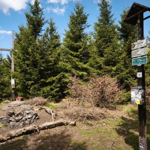
There is no chalet on the peak.
Peak is not stroller accessible.
Nice views are from a spot 40 m northwest of the summit.
There is no cable car to this peak.
No special equipment is required for this summit.
Peak is freely accessible.
Nearest peaks: Komáří vrch (906 m, 1.9 km) Výšina (848 m, 3.4 km)
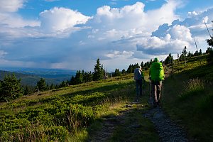 Cyklostezka Ohře: na kole po krásách Karlovarského kraje
| today | tomorrow | day after tomorrow | |
|---|---|---|---|
| Dawn: | 6:17 | 6:19 | 6:20 |
| Sunrise: | 6:51 | 6:53 | 6:54 |
| Sunset: | 16:50 | 16:48 | 16:47 |
| Dusk: | 17:24 | 17:22 | 17:21 |