Grodzisko w Konopnica (165 m a.s.l., Central Polish Lowlands)
Register and log summit

About peak Grodzisko w Konopnica
Polsko
Logged on Vrcholovka 1x in total. Vrchol Grodzisko w Konopnica was added here by Pavel Kacl and info was completed by Martin Matějka.
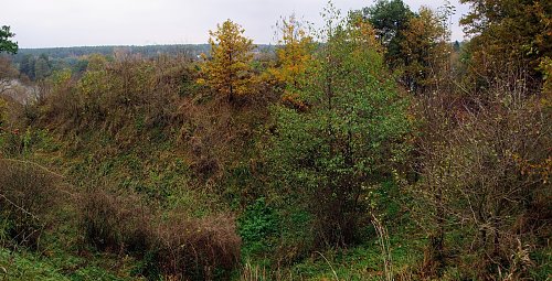
The Konopnice hillfort consists of a natural elevation on the banks of the Warta River. The area is surrounded by a moat 7 to 10 m deep. The settlement dates back to the 13th to 17th centuries.
- Chalet/accommodation
-
There is no chalet on the peak.
- Stroller access
-
Peak is not stroller accessible.
- Views
-
There are views from the peak.
- Cable car
-
There is no cable car to this peak.
- Equipment
-
No special equipment is required for this summit.
- Accessibility
-
Peak is freely accessible.
Sun
| today | tomorrow | day after tomorrow | |
|---|---|---|---|
| Dawn: | 6:28 | 6:30 | 6:31 |
| Sunrise: | 7:05 | 7:07 | 7:08 |
| Sunset: | 15:53 | 15:52 | 15:51 |
| Dusk: | 16:30 | 16:29 | 16:28 |