




Hiking, 24 km
22.6.2025
 Polsko
Logged on Vrcholovka 1x in total. Vrchol Bukowa Góra was added here by Milda.
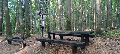
The highest peak of the Klonowskie range, towering over the western part of the Świętokrzyskie National Park. It is surrounded by extensive mixed forests dominated by beech and fir trees. It is part of the Crown of the Świętokrzyskie Mountains. The badge "Crown of the Świętokrzyskie Mountains" is a regional badge of the PTTK Świętokrzyskie branch in Kielce [https://kgs.info.pl/]. On the northern side of the main peak, there are natural rock outcrops in the form of blocks of Lower Devonian quartz sandstones. The blocks and rock monoliths reach a height of about 5 m and create a labyrinth of narrow crevices. About half a kilometer southeast of the summit, on the clearing Obrazik, there is a wooden chapel. Bukowa Góra is traversed by a green hiking trail from Starachowice to Łączny named after Jerzy Głowacki. Bukowa Góra is also the starting point of a yellow hiking trail leading to Barcza.
There is no chalet on the peak.
Peak is not stroller accessible.
There are no views from the peak.
There is no cable car to this peak.
No special equipment is required for this summit.
Peak is freely accessible.
| today | tomorrow | day after tomorrow | |
|---|---|---|---|
| Dawn: | 5:46 | 5:47 | 5:49 |
| Sunrise: | 6:20 | 6:21 | 6:23 |
| Sunset: | 16:20 | 16:19 | 16:17 |
| Dusk: | 16:54 | 16:53 | 16:51 |
