

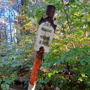

Hiking, 12 km
11.10.2026
 Česko
Prachatice (Jihočeský kraj)
Logged on Vrcholovka 18x in total. Peak information here was completed by Martin Matějka a Bouřka.
Radvanovický hřbet JZ2 is part of challenges: Šumavské tisícovky, The Highest Peaks of South Bohemia, Thousanders of the Czech Republic
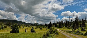
A rounded peak 1 km northeast of Český Žleb. The southwestern edge of Radvanovický hřbet. Covered with a spruce forest. The southern slopes feature meadows with preserved hedges and stone walls, offering nice views. /tisicovky.cz/
According to the current ČÚZK map, the height is 1029 m, which is 9 m more than the previously stated 1020 m and 5 m more than the first southwestern peak.
There is no chalet on the peak.
Peak is not stroller accessible.
There are no views from the peak.
There is no cable car to this peak.
No special equipment is required for this summit.
Peak is freely accessible.
Nearest peaks: Radvanovický hřbet JZ1 (1025 m, 0.4 km) Radvanovický vrch (1012 m, 1 km) Spáleniště (960 m, 1.4 km) Zlebska Hill (1080 m, 1.5 km) Radvanovický hřbet S (805 m, 2 km) Radvanovický vrch SV (972 m, 2 km) Horní Cazov (908 m, 2.1 km) Žlebský kopec SZ (920 m, 2.1 km) Hamerský les (896 m, 2.3 km) Radvanovický vrch SV2 (957 m, 2.4 km) Kamenná hlava (986 m, 2.5 km) Nad Řasnicí (797 m, 2.5 km) Radvanovický vrch SV3 (935 m, 2.6 km) Kapraď SSZ (985 m, 3 km) V Hájku (782 m, 3.2 km) Mlaka (920 m, 3.3 km) Tok (873 m, 3.5 km)
| today | tomorrow | day after tomorrow | |
|---|---|---|---|
| Dawn: | 6:15 | 6:17 | 6:18 |
| Sunrise: | 6:48 | 6:50 | 6:51 |
| Sunset: | 16:48 | 16:46 | 16:45 |
| Dusk: | 17:21 | 17:19 | 17:18 |