Luční hora (1556 m a.s.l., Giant Mountains)
Register and log summit


About Luční hoře
 Česko
Trutnov (Královéhradecký kraj)
Logged on Vrcholovka 44x in total. Peak information here was completed by Pája, Martin Matějka a Krtek.
Luční hora is part of challenges: Koruna Sudet, The Highest Mountains of Hradec Králové Region, Thousanders of the Czech Republic, Tisícovky Krkonoš, Ultrapeaks
The second highest mountain in the Czech Republic and the highest peak of the Czech Ridge. A beautiful charismatic summit, legally inaccessible, with a marked path passing about 600 meters from the peak. Circular views (here with Sněžka and Studniční hora in the background). Summit plateau with stone cairns. The highest point cannot be precisely determined; you have to walk the plateau (it's worth it).
- Chalet/accommodation
-
There is no chalet on the peak.
- Stroller access
-
Peak is not stroller accessible.
- Views
-
There are views from the peak.
- Cable car
-
There is no cable car to this peak.
- Equipment
-
No special equipment is required for this summit.
- Accessibility
-
Quiet area of KRNAP.
Nearest peaks: Stříbrné návrší (1433 m, 1.6 km) Kozí hřbety V2 (1390 m, 1.7 km) Studniční hora (1554 m, 1.7 km) Zadní Planina (1423 m, 2 km) Kozí hřbety V (1387 m, 2.2 km) Čertovo návrší (1472 m, 2.4 km) Nad Schroniskom (1241 m, 2.8 km) Lesní hora (1129 m, 3.1 km) Stříbrný hřbet (1490 m, 3.1 km) Světlý vrch (1316 m, 3.2 km)
Routes nearby
(elevation gain 1000 m, 13 km)
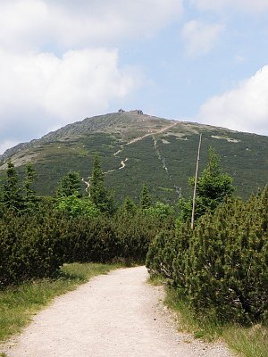 Přechod Krkonoš
(elevation gain 1800 m, 50 km)
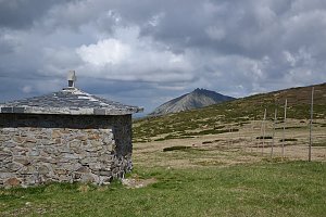
Mountain chalets
(1425 m a.s.l., 1.3 km)
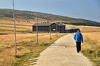
(1363 m a.s.l., 1.4 km)
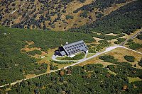
(1349 m a.s.l., 2.5 km)
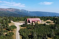
(1280 m a.s.l., 2.5 km)
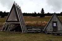
(1313 m a.s.l., 2.8 km)
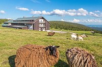
(940 m a.s.l., 3.2 km)
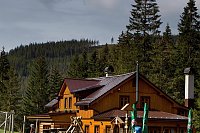
(1400 m a.s.l., 3.5 km)
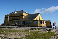
(1200 m a.s.l., 3.8 km)

(906 m a.s.l., 3.8 km)
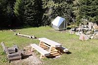
(1125 m a.s.l., 4 km)
(1100 m a.s.l., 5.9 km)
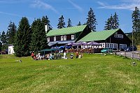
(1125 m a.s.l., 7.5 km)
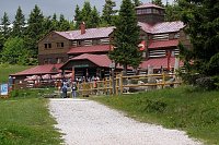
Webcams on Luční hoře
(1417 m a.s.l., 1.3 km)
 Pec pod Snezkou: Krkonoše - Luční bouda (pohled na boudu se sezením)
(1418 m a.s.l., 1.4 km)
 Pec pod Snezkou › North-East: Sněžka - Na Rozcestí
(1345 m a.s.l., 2.5 km)
 Pec pod Snezkou › North-east: Luční hora - Studniční hora - Sněžka
( 2.5 km)
 Pec pod Snezkou › North
(1034 m a.s.l., 2.6 km)
 Pec pod Sněžkou: Chalupa na Rozcestí (Krkonoše)
(1332 m a.s.l., 2.7 km)
 Špindlerův Mlýn: STOH - Svatý Petr | Špindlerův Mlýn, Czech republic
(1194 m a.s.l., 3 km)
 Borowice: Schronisko Samotnia, Karpacz
(1266 m a.s.l., 3.1 km)
 Borowice › North: Karpacz - Giant Mountains
(1278 m a.s.l., 3.2 km)
 Karpacz › East: Dom Śląski Karpacz
( 3.5 km)
 Karpacz › North: Kopa Chairlift Top Station
( 3.9 km)
 Sněžka, pohled na Studniční horu
(1561 m a.s.l., 4.1 km)
 Sněžka
(1574 m a.s.l., 4.1 km)
 Karpacz: Kopa
(1322 m a.s.l., 4.1 km)
 Strazne › North: Strážné - Czech Republic: Friesovy boudy
(1094 m a.s.l., 4.1 km)
 Mala Upa: Sněžka - lanovka
( 4.2 km)
 Mala Upa: Sněžka - lanovka
( 4.2 km)
 Karpacz: Sněžka
(1594 m a.s.l., 4.2 km)
 Pec pod Snezkou: ŚNIEŻKA
(1578 m a.s.l., 4.2 km)
 Svatý Petr: Erlebachova bouda
(1124 m a.s.l., 4.6 km)
 Pec pod Snezkou: Bobová dráha
( 4.8 km)
 Špindlerův Mlýn: Erlebachova bouda I - Špindlerův Mlýn
(1143 m a.s.l., 4.8 km)
 Pec pod Snezkou › East: Cerná Hora
(1201 m a.s.l., 5 km)
 Špindlerův Mlýn › South-West: Spindler's Mountain Hotel - Maiden Rocks - Mužské kameny - Medvědín - Wielki Szyszak
(1196 m a.s.l., 5.1 km)
 Pec pod Snezkou › West: HOTELHORIZONT
(792 m a.s.l., 5.3 km)
 Pec pod Snezkou: Schneekope
( 6.2 km)
 Pec pod Snezkou: Schneekope
( 6.2 km)
 Karpacz Gorny: Karpacz - stok Maciuś NOWOŚĆ
(803 m a.s.l., 6.3 km)
 Karpacz: Świątynia Wang 2
( 6.3 km)
 Pec pod Snezkou: Javor
( 6.4 km)
 Pec pod Snezkou: Javor
( 6.4 km)
 Tetrevi Boudy
( 6.7 km)

Sun
| today | tomorrow | day after tomorrow | |
|---|---|---|---|
| Dawn: | 6:06 | 6:07 | 6:09 |
| Sunrise: | 6:40 | 6:41 | 6:43 |
| Sunset: | 16:41 | 16:40 | 16:38 |
| Dusk: | 17:15 | 17:14 | 17:12 |