Hiking, 9 km
26.4.2026
 Česko
Litoměřice (Ústecký kraj)
Logged on Vrcholovka 48x in total. Vrchol Vrchovina was added here by Martin Matějka and info was completed by Martin Matějka, Profesorskey - Jan Bratt a Dálnice D8.
Vrchovina is part of challenges: Nejhory Středohoří, Nejhory Ústecka, The Most Prominent Mountains of the Czech Republic, Ultrakopce
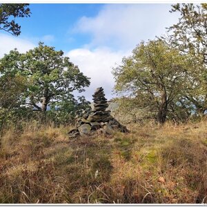
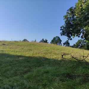
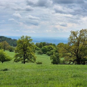
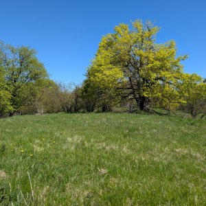
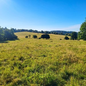
From the west, this hill of nepheline tephrite is quite unremarkable, more like a grassy rise in the middle of pastures, capped with forest. However, from the east, where the best view of Dlouhý vrch, of which it is a part, can be found, the spur of Vrchovina appears quite impressive above the village of Staňkovice. And why not, as it is the highest peak of the Varhošť Highlands, the second highest peak of the Litoměřice Uplands, and the 12th highest peak of the Czech Uplands overall. From the summit, there are views into the Lower Ohře Basin and to Říp.
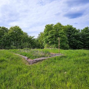
The spur of Vrchovina above Staňkovice is unmistakable, unfortunately, this ridge only has its German name - "Streitberg". At the northern edge of the summit at an elevation of 675 m, there used to be a viewpoint called "Tetschner - Aussicht", which disappeared after World War II. Since 1980, there was a military training area "Babiny" here, which was abolished along with the Litoměřice military garrison. Even today, remnants can be found here, from anti-tank barriers to semi-collapsed observation posts and trenches. Today, there are vast pastures here. To the west of the summit, on the slope towards Staňkovice, there is a once quite popular rock formation called "Amtmann" or the petrified official in the form of a rock pillar along the former "prelate's path" from Ovčárna near Tašov to Litoměřice. If you head to Vrchovina, keep these facts in mind - you are partly moving on private land and partly on pastures with cattle, which can be life-threatening.
There is no chalet on the peak.
Peak is not stroller accessible.
There are views from the peak.
There is no cable car to this peak.
No special equipment is required for this summit.
Peak is freely accessible.
Nearest peaks: Vrchovina J (674 m, 0.4 km) Špičák (608 m, 0.8 km) Babinský vrch (630 m, 1.2 km) Spálený vrch (578 m, 1.3 km) Rýdečský vrch (553 m, 1.4 km) Dlouhý vrch (658 m, 1.5 km) Homolka (616 m, 1.5 km) Dlouhý vrch JZ (649 m, 1.6 km) Kupa (635 m, 1.8 km) Dlouhý vrch JV (633 m, 1.9 km) Pískový vrch (394 m, 2.1 km) Panenský kámen (608 m, 2.4 km) Lysá hora (577 m, 2.5 km) Kamenný vrch (656 m, 2.7 km) Křížová hora (590 m, 2.9 km) Hradiště (545 m, 3.3 km) Kukla (674 m, 3.3 km) Lucemburkův kopec (564 m, 3.3 km) Kamýk (455 m, 3.6 km) Zadní vrch (528 m, 3.6 km) Dwarf Stones (671 m, 3.7 km)
| today | tomorrow | day after tomorrow | |
|---|---|---|---|
| Dawn: | 7:05 | 7:07 | 6:09 |
| Sunrise: | 7:39 | 7:41 | 6:42 |
| Sunset: | 17:56 | 17:54 | 16:52 |
| Dusk: | 18:29 | 18:27 | 17:25 |