Kirkjufell (463 m a.s.l., Island)
Register and log summit

About peak Kirkjufell
 Island
Vrchol Kirkjufell was added here by Martin Matějka.
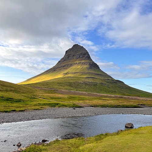
The mountain was formed during the glaciation period as a nunatak, giving it a characteristic shape resembling a roof with steep walls, rising directly from the sea coast. In the Middle Ages, it was known as Sukkurtoppen (sugar cone), and the current name Kirkjufell means Church Mountain. At the foot of the mountain lies the Kirkjufellfoss waterfall. Due to its uniqueness, it is an important landmark and one of the most photographed locations in Iceland.
- Chalet/accommodation
-
There is no chalet on the peak.
- Stroller access
-
Peak is not stroller accessible.
- Views
-
There are views from the peak.
- Cable car
-
There is no cable car to this peak.
- Equipment
-
The trail is secured with ropes in difficult sections
- Accessibility
-
Peak is freely accessible.
Sun
| today | tomorrow | day after tomorrow | |
|---|---|---|---|
| Dawn: | 8:11 | 8:14 | 8:17 |
| Sunrise: | 9:05 | 9:08 | 9:11 |
| Sunset: | 17:29 | 17:25 | 17:22 |
| Dusk: | 18:22 | 18:19 | 18:16 |