


Hiking, 6 km
27.8.2025
 Česko
Ústí nad Orlicí (Pardubický kraj)
Logged on Vrcholovka 45x in total. Vrchol Bath was added here by Patejl and info was completed by Martin Matějka.
Bath is part of challenges: Crown of Czechia, Nejhory Pardubicka, Nejhory Zábřežské
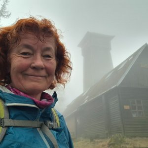
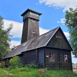
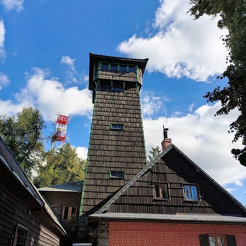
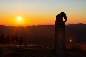
The highest mountain of the Zábřežská Highlands. At the top there is a lookout tower of the same name with Reichlová chata. Not far from the cottage is a monument to the fallen who belonged to the National Association of Patriots and fell in the fight against the occupiers.
The Zábřežská Highlands has an area of 734 km², to the north it is bordered by the foothills of the Hrubý Jeseník and the Orlické Mountains, to the south by the Drahanská Highlands, to which it continues continuously. The western and eastern edges of this highland are lined with steep marginal slopes. From a geological point of view, the area is mainly composed of gneiss, schist and chert. In the Bouzovsko region, Devonian limestones emerge in nature reserves and the tourist-attractive Javořičské and Mladečské caves.
There is a chalet on the peak.
This peak is accessible with a stroller.
There are views from the peak.
There is no cable car to this peak.
No special equipment is required for this summit.
Peak is freely accessible.
Nearest peaks: Louková hora (615 m, 0.7 km) Velký Klínek (685 m, 0.7 km) Pod kotlem (569 m, 1.2 km) Hraniční vrch (547 m, 1.4 km) U rychty (631 m, 1.4 km) Horní Klínek (646 m, 1.5 km) Na Lánech (624 m, 1.6 km) Za Brodkem (596 m, 1.6 km) Stráně (645 m, 1.7 km) U Jeřábka (606 m, 1.7 km) Vrchy (660 m, 2.1 km) Vlčí vrch (585 m, 2.3 km) Swedish Chances (655 m, 2.4 km) V Jedlinách (619 m, 2.4 km) U Chudoby (635 m, 2.5 km) Horní Chudobské (629 m, 2.6 km) Obžár (679 m, 2.6 km) Paseka (650 m, 3 km) Slovensko (552 m, 3 km) Triangl (519 m, 3.1 km) Na Větru (706 m, 3.2 km) Dolní Slovensko (542 m, 3.3 km) Chudoba (655 m, 3.3 km) V Jedlinách JV (618 m, 3.4 km)
 Přechod Králického Sněžníku a Jeseníků
 Cenkovice: SKI areál Čenkovice
 Cenkovice
 Cenkovice
 Cenkovice: Horský Resort Buková Hora - Čenkovice - Sjezdovka Třebovská
 Čenkovice
 Cervena Voda: Červená Voda - Čenkovice - Červená Voda, sjezdovka
 Cervena Voda: Červená Voda - Čenkovice - Červená Voda, apartmany
 Cenkovice: SKI areál Čenkovice
 Cenkovice › South-east
 Cenkovice: SKI areál Čenkovice
 Cenkovice › South-east: Vlek U pramene
 Svitavská sjezdovka

| today | tomorrow | day after tomorrow | |
|---|---|---|---|
| Dawn: | 6:56 | 5:58 | 5:59 |
| Sunrise: | 7:29 | 6:31 | 6:32 |
| Sunset: | 17:45 | 16:43 | 16:41 |
| Dusk: | 18:18 | 17:16 | 17:14 |