

Hiking, 34 km
27.6.2026
 Česko
Semily (Liberecký kraj)
Logged on Vrcholovka 69x in total. Peak information here was completed by Pavel Martínek a Martin Matějka.
Šeřín is part of challenges: Koruna Sudet, Nejhory Liberecka, Thousanders of the Czech Republic, Tisícovky Krkonoš
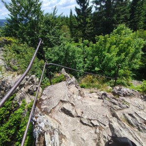
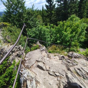
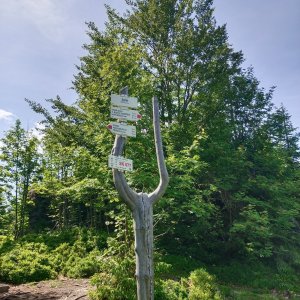
A prominent peak with a flat summit, crowned by a distinctive rock, approximately 5-8 m high and 40 m long, extending in an east-west direction. The eastern part features a well-maintained staircase, an observation platform, and a railing.
There is no chalet on the peak.
Peak is not stroller accessible.
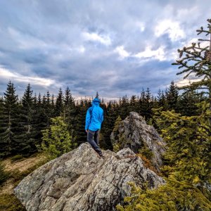
There are views from the peak.
There is no cable car to this peak.
No special equipment is required for this summit.
Peak is freely accessible.
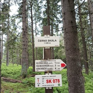
Nearest peaks: Černá skála (1042 m, 1.4 km) Janský vrch (925 m, 1.9 km) Velký Jeřábník (892 m, 1.9 km) Vídeňská skála (968 m, 3.4 km)
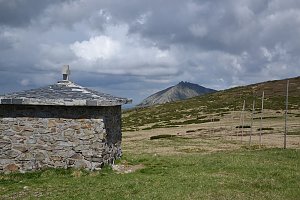 Labská stezka
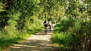 Přechod Krkonoš s dětmi
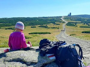 Via Czechia: Severní stezka

 Vitkovice: Vitkovice v Krkonosich: Lyžařský areál Janova Hora - Sjezdovka
 Vitkovice: v Krkonoších - v Krkonoších II, POI 1
 Vitkovice: v Krkonoších - v Krkonoších II, POI 2
 Spindleruv Mlyn: Penzion Alenka - Labská, Přehrada
 Špindlerův Mlýn › North-West: Pension Alenka Spindleruv Mlyn
 Spindleruv Mlyn: Hromovka
 Benecko: Obec - Dětský park
 Benecko
 Skelné Hutě: Rezek − pension Hájenka
 Benecko: Ski Kraj
 Benecko: Obec - Štěpanická Lhota, Kejnos
 Predni Labska: Město Špindlerův Mlýn - Svatý Petr, Pláně
 Bedrichov: Svatý Petr - Pláň - Špindlerův Mlýn
 Spindleruv Mlyn › South-East
 Bedrichov: Špindlerův Mlýn: Hromovka
 Spindleruv Mlyn: Svaty Petr II, Nástup Lanovky
 Spindleruv Mlyn: Svaty Petr II, Restaurace
 Benecko: Herlíkovice, Bubákov - Žalý
 Vitkovice: Spindlermühle - Horní Mísečky
 Vitkovice: Spindlermühle - Horní Mísečky
 Strazne › North: Strážné
 Vrchlabi: Herlíkovice, Bubákov - Herlíkovice II
 Špindlerův Mlýn: Krkonoše, Špindlerův Mlýn, Medvědín (pohled na Labskou přehradu)
 Špindlerův Mlýn: Krkonoše, Špindlerův Mlýn, Medvědín (pohled na Kozí hřbety)
 Medvědín
 Vitkovice: Vrbatova Bouda
 Rokytnice nad Jizerou › South-West
 Rokytno: Rokytnice n. Jizerou, Lysá hora
 Rokytno: Lysá hora - Rokytnice
 Rokytno: Lysá hora - Rokytnice
 Rokytno: Lysá Hora

| today | tomorrow | day after tomorrow | |
|---|---|---|---|
| Dawn: | 7:00 | 7:02 | 6:03 |
| Sunrise: | 7:33 | 7:35 | 6:37 |
| Sunset: | 17:50 | 17:48 | 16:46 |
| Dusk: | 18:23 | 18:21 | 17:20 |