Fundusfeiler (3079 m a.s.l., Ötztal Alps)
Register and log summit

About peak Fundusfeiler
 Rakousko
Vrchol Fundusfeiler was added here by Milan "Hojší" Průžek and info was completed by Milan "Hojší" Průžek.
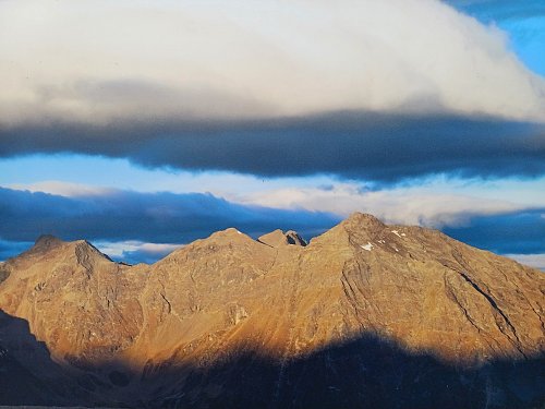
Fundusfeiler is a mountain in the Geigenkamm group of the Ötztal Alps.
Due to its easy accessibility from several mountain huts, it is a popular, easily climbed panoramic mountain.
Given its easy access from the valley and straightforward ascent, there are no records of a documented first ascent of Fundusfeiler. The mountain is well developed with an extensive network of hiking trails and is often climbed in both summer and winter. The normal route, the easiest ascent, is from the southern side of the mountain. The Frischmannhütte, located at an altitude of 2,192 meters at the end of the Fundus valley, serves as a suitable base from which the summit can be reached in about two hours of walking via Feilerscharte and a subsequent easy climb at UIAA grade I. From the Erlanger Hütte (2,541 m) to the north of Wildgrat, an exposed high-altitude trail leads to the summit in four hours via Feilerscharte. You should also account for four hours to ascend from the Ludwigsburger Hütte (1,935 m) to the west, above Zaunhof, via Lehnerjoch (2,510 m).
Curiosity: Ötzi, the ice man, was found here.
- Chalet/accommodation
-
There is no chalet on the peak.
- Stroller access
-
Peak is not stroller accessible.
- Views
-
There are views from the peak.
- Cable car
- Equipment
-
No special equipment is required for this summit.
- Accessibility
-
Peak is freely accessible.
Routes nearby
Routes provided by SvetOutdooru.cz
Mountain chalets

Webcams
Cameras provided by windy.com
Sun
| today | tomorrow | day after tomorrow | |
|---|---|---|---|
| Dawn: | 7:13 | 7:15 | 7:16 |
| Sunrise: | 7:44 | 7:46 | 7:47 |
| Sunset: | 18:17 | 18:15 | 18:13 |
| Dusk: | 18:48 | 18:46 | 18:44 |