


Cycling, 57 km
16.8.2024
 Česko
Teplice (Ústecký kraj)
Logged on Vrcholovka 3x in total. Vrchol Nad Moldavou was added here by Tor and info was completed by Martin Matějka a Tor.
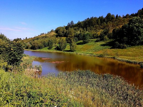
An elongated, dominant ridge, mostly deforested, located north of Dolní Moldava. From the summit, there is a panoramic view of the surrounding "eight-thousanders." Along the southern foothills of the ridge flows the Moldavský stream, feeding unnamed ponds. - Here, above the valley of the Moldavský stream, fluorite was mined from 1954 to 1997. (Josef Mine.) A significant and rich deposit, also the site of the largest fluorite crystal found in the Czech Republic with a cube edge of 29 cm. Free fluorite crystals (especially barite aggregates) can still be found in the remnants of the vein in the surface mining area on the southwestern, forested slope of the hill.
There is no chalet on the peak.
Peak is not stroller accessible.
There are views from the peak.
There is no cable car to this peak.
No special equipment is required for this summit.
Peak is freely accessible.
Nearest peaks: U Hranice (785 m, 1.6 km) Nad Křížkem (857 m, 2.2 km) Schickels Höhe (805 m, 2.4 km) Oldřišský vrch (877 m, 3 km)
 Holzhau › West: Rodelhang
 Holzhau: Skihang in
 Moldava › North-east
 Nové Město: Bouřňák Horská služba stanice
 Moldava › East: Pramenáč
 Moldava › South: Bouřňák - Ústecký kraj, Česko
 Moldava
 Nove Mesto u Mikulova: Sport Centrum Bouřňák - Vrchol Bouřňák, pohled na jih
 Altenberg: Skilift Am Rotterhang

| today | tomorrow | day after tomorrow | |
|---|---|---|---|
| Dawn: | 6:12 | 6:14 | 6:16 |
| Sunrise: | 6:46 | 6:48 | 6:50 |
| Sunset: | 16:52 | 16:50 | 16:48 |
| Dusk: | 17:25 | 17:24 | 17:22 |