Mont de l'Arpille (2085 m a.s.l., Mont Blanc)
Register and log summit


About peak Mont de l'Arpille
 Švýcarsko
Vrchol Mont de l'Arpille was added here by Milan "Hojší" Průžek.
Elevation: 559 m
Ascent time: 2 hours
Risk: none
Ascent:
Col de la Forclaz is a pass between Chamonix and Martigny, still on the Swiss side. It is often walked to the Forclaz glacier, which is about an hour and a half long nice hike almost along the contour (from the pass heading southeast, to the left if coming from the Swiss side). Ice was mined from the Forclaz glacier in the nineteenth century - just see what the Swiss can sell. Anyone can easily imagine the melting of the Alpine glaciers when they find out that from the former "station" it will still take a good half hour to walk to the place where the glacier ends today.
The ascent to Mont de l'Arpille is less popular because it goes uphill. We park at the pass near the inn. We look around well and search for a faint path that leads from the inn roughly northward up the slope (to the right for those looking into France). We hike uphill in the forest for about an hour and are rewarded when we reach a beautiful plateau with plenty of flowers and views of both Mont Blanc and the Rhone valley.
Col de la Forclaz - summit 2 h (cepr)
- Chalet/accommodation
-
There is no chalet on the peak.
- Stroller access
-
Peak is not stroller accessible.
- Views
-
There are views from the peak.
- Cable car
-
There is no cable car to this peak.
- Equipment
-
No special equipment is required for this summit.
- Accessibility
-
Peak is freely accessible.
Routes nearby
(elevation gain 3000 m, 26 km)
 Výstup na Aiguille du Chardonnet vstupenka do alpinismu
(elevation gain 2600 m, 20 km)
Mountain chalets
Webcams
( 2.5 km)
 Trient: Plateau du Trient
(1305 m a.s.l., 2.5 km)
 Martigny: Ravoire - Ville
(732 m a.s.l., 4.6 km)
 Martigny-Bourg: Martigny
(713 m a.s.l., 4.6 km)
 Ravoire: Vue sur la route du Col de la Forclaz sur Martigny − France
(713 m a.s.l., 4.7 km)
 Salvan: La Creusaz
(1773 m a.s.l., 4.7 km)
 Salvan: Télé Marécottes
( 4.7 km)
 Martigny-Combe: Ravoire
(1137 m a.s.l., 4.9 km)
 Chamonix-Mont-Blanc: Tête de Balme
( 6.2 km)
 Chamonix-Mont-Blanc: Col de Balme (Chamonix-Mont Blanc)
(2236 m a.s.l., 6.2 km)
 Martigny
( 6.7 km)
 Vernayaz
( 6.9 km)
 Chamonix-Mont-Blanc: Les Grandes Autannes
( 6.9 km)
 Vallorcine
( 6.9 km)
 Vernayaz
(453 m a.s.l., 7.1 km)
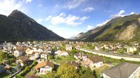 Chamonix-Mont-Blanc › South: Mont Blanc
( 7.4 km)
Sun
| today | tomorrow | day after tomorrow | |
|---|---|---|---|
| Dawn: | 6:44 | 6:45 | 6:46 |
| Sunrise: | 7:15 | 7:16 | 7:18 |
| Sunset: | 17:15 | 17:14 | 17:12 |
| Dusk: | 17:46 | 17:45 | 17:44 |