Le Grammont (2172 m a.s.l., Chablais-Faucigny)
Register and log summit


About peak Le Grammont
 Švýcarsko
Vrchol Le Grammont was added here by Milan "Hojší" Průžek and info was completed by Martin Matějka.
On the way to the summit, there is the mountain lake Lac de Taney.
Grammont in the morning sun by Ferdinand Hodler.
It is believed that the event in Tauredunum in 563 AD took place on the slopes of Le Grammont, named after a Roman-era fortress that was located near the spot where the Rhôna flows into Lake Geneva.
During World War II, there was an incident where a Royal Air Force Lancaster was shot down by Swiss anti-aircraft gunners and crashed into the mountain. The pilot of the aircraft was Horace Badge and the entire crew was lost.
Elevation: a modest 1100 m
Ascent time: 3 hours
Risk: none
Ascent:
We start from the same place as on the trip to Cornettes de Bise. From the small town of Vouvry at the eastern end of Lake Geneva, we head up the slopes towards Miex via switchbacks. We pass Miex, at the sign marking the end of the settlement Flon, we turn right and immediately park in a large parking lot. From the parking lot, we go straight up the slope on the hiking trail towards Tanay and for an hour we cross a dirt road, which we could drive up to Lake Tanay if we had a 4x4 vehicle. At the lake, we are bored, so we take a swim, which lifts our spirits again. Grammont is the mountain above us and there is a marked path leading to the summit. The summit is directly above Lake Geneva, which we look at from a nice height (see photo at Rochers de Naye).
Parking lot - Lake Tanay 1 h (cepr)
Lake - summit 2 h (cepr)
- Chalet/accommodation
-
There is no chalet on the peak.
- Stroller access
- Views
-
There are views from the peak.
- Cable car
-
There is no cable car to this peak.
- Equipment
-
No special equipment is required for this summit.
- Accessibility
-
Peak is freely accessible.
Routes nearby
Routes provided by SvetOutdooru.cz
Webcams
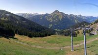
Cameras provided by windy.com

Sun
| today | tomorrow | day after tomorrow | |
|---|---|---|---|
| Dawn: | 6:37 | 6:38 | 6:39 |
| Sunrise: | 7:08 | 7:09 | 7:11 |
| Sunset: | 17:24 | 17:23 | 17:21 |
| Dusk: | 17:55 | 17:54 | 17:52 |