Vihorlat (1076 m a.s.l., Vihorlatské vrchy)
Register and log summit
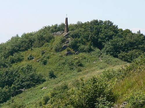

About peak Vihorlat
 Slovensko
Prešovský kraj
Logged on Vrcholovka 53x in total. Vrchol Vihorlat was added here by Jarda Vála and info was completed by Malek Belhadj, Martin Matějka a Rastislav Biarinec.
Vihorlat is part of challenges: Highest Points of Geomorphological Units of Slovakia, Highest SK, Slovensko 200+
The summit is located within a nature reserve, where entry is only permitted along marked hiking trails. However, only an unofficial red trail leads to the summit.
The summit is situated in the military area of Valaškovce. Before entering, individuals must ensure that there is no temporary entry ban in effect:
https://www.mod.gov.sk/vstupy-do-vojenskych-obvodov/
- Chalet/accommodation
-
There is no chalet on the peak.
- Stroller access
-
Peak is not stroller accessible.
- Views
-
There are views from the peak.
- Cable car
-
There is no cable car to this peak.
- Equipment
-
No special equipment is required for this summit.
- Accessibility
-
PR Vihorlatský prales - there is no marked hiking trail leading to the summit.
Nearest peaks: Vihorlat V (1071 m, 0.2 km) Vihorlat JV (1073 m, 0.4 km) Malé Tŕstie (966 m, 1.3 km) Glacier (894 m, 1.7 km) Malý Peňažník (738 m, 2.3 km) Divá (835 m, 3.3 km)
Sun
| today | tomorrow | day after tomorrow | |
|---|---|---|---|
| Dawn: | 5:35 | 5:36 | 5:38 |
| Sunrise: | 6:07 | 6:09 | 6:10 |
| Sunset: | 16:23 | 16:22 | 16:20 |
| Dusk: | 16:56 | 16:54 | 16:52 |