





Hiking
so, 26.10.2024, 15:53
 Rakousko
Logged on Vrcholovka 1x in total. Vrchol Rettlkirchspitze was added here by Martin Matějka and info was completed by Jiří Králík.
Rettlkirchspitze is part of challenge: King of the Low Tatras
The highest peak of the Rottenmann and Wölz Tauern mountain range.
Summit cross. Difficulty T2 from the east, the ridge from the west is T3.
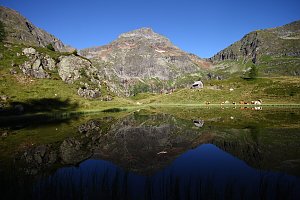
The photograph shows the main peak on the left, the secondary peak on the right, and the limestone tower Funklturm between them.
There is no chalet on the peak.
Peak is not stroller accessible.
There are views from the peak.
There is no cable car to this peak.
No special equipment is required for this summit.
Peak is freely accessible.
Nearest peaks: Kleiner Rettlkirchspitze (2446 m, 0.3 km) Funklturm (2381 m, 0.5 km) Hochstubofen (2385 m, 1.4 km) Strasseck (2390 m, 1.4 km) Narrenspitze (2336 m, 2.1 km) Aarfeldspitz (2284 m, 2.2 km) Greim (2474 m, 2.3 km) Sandkogel (2214 m, 3.1 km)
 Solk: Sölkpass - Blick nach Norden

| today | tomorrow | day after tomorrow | |
|---|---|---|---|
| Dawn: | 6:06 | 6:07 | 6:09 |
| Sunrise: | 6:37 | 6:39 | 6:40 |
| Sunset: | 16:57 | 16:55 | 16:53 |
| Dusk: | 17:28 | 17:26 | 17:25 |