

Hiking, 41 km
27.9.2026
 Česko
 Polsko
Šumperk (Olomoucký kraj)
Logged on Vrcholovka 56x in total. Peak information here was completed by araba, Martin Matějka a Jiří Králík.
Kunčický hřbet is part of challenges: Koruna Sudet, Menagerie, Nejhory Kladska, Nejhory Olomoucka, Nejhory Rychleb, Thousanders of the Czech Republic, Thousanders of the Jeseníky, Via Czechia Severní stezka
Polish name Rude Krzyże.
There is no chalet on the peak.
Peak is not stroller accessible.
There are no views from the peak.
There is no cable car to this peak.
No special equipment is required for this summit.
Peak is freely accessible.
Nearest peaks: U červeného kříže (1026 m, 0.8 km) Orlik (1068 m, 0.9 km) Jawornicka Kopa (1056 m, 1.4 km) Jívina (1076 m, 1.4 km) Polská hora (1106 m, 1.4 km) Chlupenkovec (980 m, 1.9 km) Mlžný vrch (975 m, 2 km) Bílé kameny (1029 m, 2.3 km) Swidnica (1048 m, 2.4 km) Stolec S (1022 m, 2.5 km) Sucha Kopa V (1054 m, 2.5 km) Malý Chlupenkovec (947 m, 2.9 km) Stolec (1034 m, 3.1 km) Zawodzisko (992 m, 3.1 km) Palaš (1025 m, 3.5 km) Ostrega (985 m, 3.7 km) Szeroka Kopa (907 m, 3.7 km)
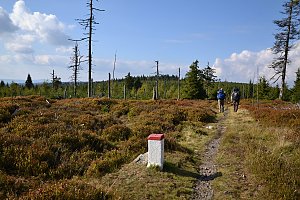 Via Czechia - Stezka Slezkem
 Velke Vrbno: Snow park Paprsek - Lanovka - pohled nahoru
 Velké Vrbno: Hotel Paprsek
 Velké Vrbno: Hotel Paprsek
 Velké Vrbno: Snow park Paprsek
 Velke Vrbno: Snow park Paprsek - Nástup na lanovku
 Stare Mesto › North-West
 Stare Mesto › South-West: Ski resort Kunčice
 Stare Mesto: Stare Mesto pod Kralickym Sneznikem: SKITECH Kunčice - Lyžařská škola a dětské hřiště

| today | tomorrow | day after tomorrow | |
|---|---|---|---|
| Dawn: | 6:00 | 6:02 | 6:03 |
| Sunrise: | 6:34 | 6:35 | 6:37 |
| Sunset: | 16:37 | 16:36 | 16:34 |
| Dusk: | 17:11 | 17:09 | 17:08 |