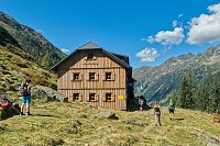


Hiking, 12 km
19.8.2023
 Rakousko
Logged on Vrcholovka 15x in total. Vrchol Hochgolling was added here by Olmerson and info was completed by Milan "Hojší" Průžek a Martin Matějka.
Hochgolling is part of challenges: Austrian Alps, King of the Low Tatras
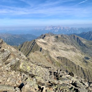
The highest mountain of the Low Tauern mountain range located in the federal states of Styria and Salzburg in Austria. It lies in the subrange of the Schladming Tauern on the border of the federal states of Salzburg and Styria. To the north, it drops 1200 meters with a sheer rock face into the Gollingwinkel basin. It towers over its surroundings by several hundred meters, providing excellent views of a significant part of Austria (the Dachstein massif, Hochkönig, Totes Gebirge, High Tauern, etc.).
The first ascent of the highest peak of the Low Tauern is dated back to 1791 by unknown citizens from Tamsweg, led by a Bavarian land surveyor. The first ascent via the current normal route was made in 1817 by Archduke Johann.
Surroundings
The valleys around Hochgolling are very long, and this characteristic applies to all valleys that extend between the numerous southern ridges of the main ridge of the Low Tauern. This part of the mountains belongs to the Salzburg region known as Lungau. Here, one can still encounter folklore, and many customs and traditions are repeated regularly every year.
Ascent Route
North
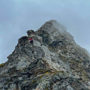
The current classic and most frequented route leads from the Gollinghütte hut from the north of the massif. From the Gollingscharte saddle, it is possible to ascend to the summit via the northwestern ridge with climbing sections of difficulty I-II. UIAA. Length: Riesachfälle – Gollinghütte – Hochgolling (7 hours) – descent (6 hours) Total 13 hours.
South
The southern variant leading through the long Göriachtal valley is significantly less frequented and considerably longer. Length: Hintergöriach – Vord. Göriachalm – Hochgolling (8 hours) – descent (6.5 hours) Total 14.5 hours (suitable to split into two days).
Huts
Gollinghütte (1641 m)
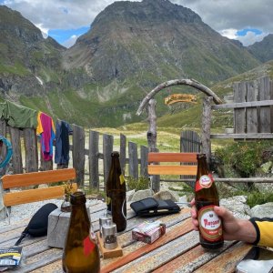
A wooden hut located almost under the northern wall of Hochgolling on a grassy terrace above the valley. It is owned by the Alpine Club (Prein section) and has 80 beds available. It operates from June 15 to September 30.
Landawirseehütte (1985 m)
A hut under the western spur of the Hochgolling ridge, owned by the Alpine Club (Lungau section). It has a capacity of 45 beds and 4 places in the winter room. The hut is primarily used during ascents from the south.
Important peaks of the Schladming Tauern group:
Hochgolling (2863 m)
Hochwildstelle (2747 m)
Roteck (2742 m)
Preber (2740 m)
Kasereck (2740 m)
Waldhorn (2702 m)
Deichselspitz (2684 m)
Kieseck (2681 m)
Elendberg (2672 m)
Umlauter (2664 m)
Zwerfenberg (2642 m)
Greifenberg (2618 m)
Großer Knallstein (2599 m)
Hohes Schareck (2575 m)
Höchstein (2543 m)
Predigtstuhl (2543 m)
Zinkwand (2442 m)
Hauser Kaibling (2015 m)
Hochwurzen (1850 m)
There is no chalet on the peak.
Peak is not stroller accessible.
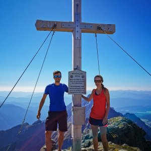
There are views from the peak.
There is no cable car to this peak.
No special equipment is required for this summit.
Peak is freely accessible.
Nearest peaks: Norden Gollingturm (2753 m, 0.4 km) Kleines Zwerfenberg (2396 m, 1.1 km) Kleines Gangl (2478 m, 1.6 km) Zwerfenberg (2642 m, 1.6 km) Elendberg (2672 m, 2.2 km) Großes Gangl (2602 m, 2.4 km) Schottwiegenhöhe (2523 m, 2.9 km) Greifenberg (2618 m, 3.3 km) Kasereck (2740 m, 3.3 km)
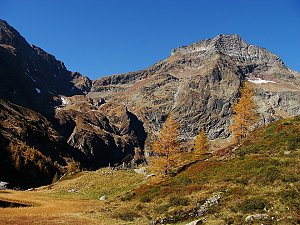 Túra po hřebeni Preber - Roteck ve Schladmingských Taurách
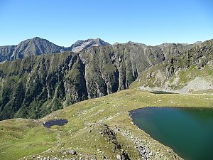 Výstup na Hochwildstelle
| today | tomorrow | day after tomorrow | |
|---|---|---|---|
| Dawn: | 7:05 | 6:06 | 6:07 |
| Sunrise: | 7:36 | 6:37 | 6:39 |
| Sunset: | 18:01 | 17:00 | 16:58 |
| Dusk: | 18:33 | 17:31 | 17:29 |