Plešný (1066 m a.s.l., Šumavské podhůří)
Register and log summit
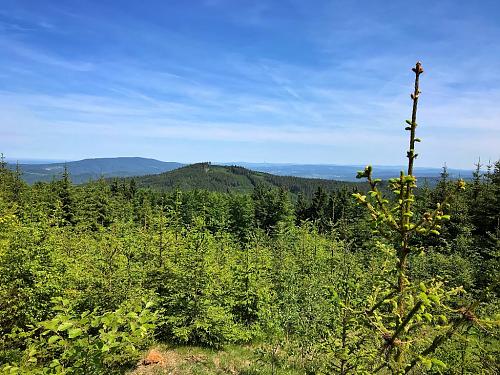

About peak Plešný
 Česko
Český Krumlov (Jihočeský kraj)
Logged on Vrcholovka 7x in total. Peak information here was completed by Pája a Martin Matějka.
Plešný is part of challenges: Nejhory Pošumaví, Šumavské ultratisícovky, The Highest Peaks of South Bohemia, Thousanders of the Czech Republic, Ultrapeaks
The third highest mountain of the Šumava foothills and the highest peak of its subrange, the Českokrumlovská Highlands, located less than a kilometer from the border with Šumava. The slopes are covered with spruce forests and strewn with boulders and rock outcrops. It is situated in the Boletice Military District, over 2 km from the nearest accessible point.
- Chalet/accommodation
-
There is no chalet on the peak.
- Stroller access
-
Peak is not stroller accessible.
- Views
-
There are no views from the peak.
- Cable car
-
There is no cable car to this peak.
- Equipment
-
No special equipment is required for this summit.
- Accessibility
-
The summit is located in the Boletice Military District, the highest accessible point is 2.3 km to the north, 300 meters lower in elevation.
Nearest peaks: Plešný J (1001 m, 0.8 km) Nad Lomkem (898 m, 1 km) Nad Lomkem SV (894 m, 1.2 km) Malý Plešný (881 m, 1.4 km) Nad Vítěšovickým statkem (735 m, 1.4 km) Velký Plešný S (835 m, 1.6 km) Nad Ondřejovskou cestou (811 m, 2 km) Hůrka (698 m, 2.2 km) Chlum (1191 m, 2.2 km) Nad Myslivnou S (1004 m, 2.3 km) Příčník S (889 m, 2.3 km) U kostela (1010 m, 2.3 km) Vítěšovice (670 m, 2.3 km) Chlumek (1027 m, 2.5 km) Pod Břidly (790 m, 2.6 km) Matuškův kopec (789 m, 2.7 km) Nad Myslivnou (1006 m, 2.9 km) Rovence Z (791 m, 2.9 km) Příčník (961 m, 3 km) Rovence JZ (779 m, 3.1 km) Příčník J2 (960 m, 3.3 km) Rovence (801 m, 3.4 km) Alfenberg (988 m, 3.7 km)
Sun
| today | tomorrow | day after tomorrow | |
|---|---|---|---|
| Dawn: | 7:04 | 7:05 | 6:07 |
| Sunrise: | 7:36 | 7:37 | 6:39 |
| Sunset: | 17:59 | 17:57 | 16:55 |
| Dusk: | 18:31 | 18:29 | 17:28 |