



Hiking
út, 29.8.2023, 7:25
 Slovensko
Banskobystrický kraj
Logged on Vrcholovka 1x in total. Vrchol Maxina was added here by Norbert Mogyorósi and info was completed by Norbert Mogyorósi a Martin Matějka.
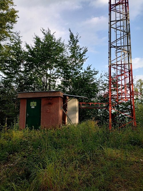
The highest peak of a short mountain ridge located between the villages of Muránska Dlhá Lúka, Muránska Lehota, and Muráň, which is in the northernmost part of the subunit of the Stolické Mountains Tŕstie. The summit is marked by a triangulation point and has a telecommunications transmitter on it. On some maps, the name Maxima also appears.
There is no chalet on the peak.
Peak is not stroller accessible.
Limited views to the south towards the Muránska Plain.
There is no cable car to this peak.
No special equipment is required for this summit.
Peak is freely accessible.
Nearest peaks: Kamenná (718 m, 1.9 km) Ostrý vrch (730 m, 2.1 km) Holá hora (676 m, 2.4 km) Petrov vrch (785 m, 2.7 km)
| today | tomorrow | day after tomorrow | |
|---|---|---|---|
| Dawn: | 6:40 | 6:41 | 5:43 |
| Sunrise: | 7:12 | 7:13 | 6:15 |
| Sunset: | 17:35 | 17:34 | 16:32 |
| Dusk: | 18:08 | 18:06 | 17:04 |