Pöllerhöhe (2601 m a.s.l., Schladmingské Taury)
Register and log summit


About peak Pöllerhöhe
 Rakousko
Vrchol Pöllerhöhe was added here by Jiří Králík and info was completed by Martin Matějka.
At the summit, there is a summit cross. There is no official trail to the top. The easiest ascent is from the Schottwiegenscharte saddle. It has two peaks, the lower northern and the higher southern.
Photo: Jiří Králík
- Chalet/accommodation
-
There is no chalet on the peak.
- Stroller access
-
Peak is not stroller accessible.
- Views
-
There are views from the peak.
- Cable car
-
There is no cable car to this peak.
- Equipment
-
No special equipment is required for this summit.
- Accessibility
-
Peak is freely accessible.
Nearest peaks: Schottwiegenhöhe (2523 m, 0.3 km) Großes Gangl (2602 m, 0.5 km) Klafferturm (2536 m, 0.8 km) Greifenberg (2618 m, 0.9 km) Kleines Gangl (2478 m, 1.3 km) Klafferkogel (2378 m, 1.5 km) Kapuzinerberg (2446 m, 1.6 km) Klein Reislingkogel (2360 m, 1.8 km) Reislingkogel (2370 m, 2 km) Greifenstein (2397 m, 2.1 km) Waldhorn (2702 m, 2.6 km)
Routes nearby
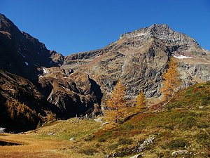 Výstup na Hochwildstelle
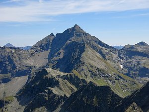 Túra po hřebeni Preber - Roteck ve Schladmingských Taurách


Sun
| today | tomorrow | day after tomorrow | |
|---|---|---|---|
| Dawn: | 7:03 | 7:04 | 6:06 |
| Sunrise: | 7:34 | 7:36 | 6:37 |
| Sunset: | 18:03 | 18:01 | 17:00 |
| Dusk: | 18:34 | 18:33 | 17:31 |