Breznianska hoľa (878 m a.s.l., Podbeskydská brázda)
Register and log summit


About peak Breznianska hoľa
 Slovensko
Žilinský kraj
Logged on Vrcholovka 1x in total. Vrchol Breznianska hoľa was added here by Rastislav Biarinec and info was completed by Rastislav Biarinec a Martin Matějka.
The peak is also referred to as the highest point of the geomorphological unit Podbeskydská brázda.
- Chalet/accommodation
-
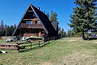
There is no chalet on the peak.
- Stroller access
-
Peak is not stroller accessible.
- Views
-
There are no views from the peak.
- Cable car
-
There is no cable car to this peak.
- Equipment
-
No special equipment is required for this summit.
- Accessibility
-
CHKO Horná Orava - Zone C (3rd degree of protection) - there is no marked hiking trail leading to the summit.
Nearest peaks: Okrúhle (954 m, 1.1 km) Polom (973 m, 2.1 km) Konárne SSZ (1016 m, 2.4 km) Tokárovka (908 m, 2.4 km) Minčol (1273 m, 2.6 km) Komárne (1020 m, 2.9 km) Grúniky (928 m, 3 km)
Mountain chalets
Webcams
(1261 m a.s.l., 4.6 km)
 Korbielow › South-East
(335 m a.s.l., 5.8 km)
 Korbielow › North
(335 m a.s.l., 5.8 km)
 Korbielow › North-East
(331 m a.s.l., 6.1 km)
 Hala Miziowa › East: Babia Góra
(1271 m a.s.l., 6.2 km)
 Korbielow
(1282 m a.s.l., 6.3 km)

Sun
| today | tomorrow | day after tomorrow | |
|---|---|---|---|
| Dawn: | 5:51 | 5:53 | 5:54 |
| Sunrise: | 6:24 | 6:26 | 6:28 |
| Sunset: | 16:28 | 16:26 | 16:25 |
| Dusk: | 17:01 | 16:59 | 16:58 |