Končisté (1474 m a.s.l., Low Tatras)
Register and log summit
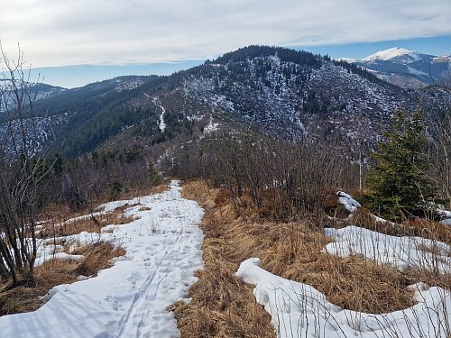

About peak Končisté
 Slovensko
Banskobystrický kraj
Logged on Vrcholovka 1x in total. Vrchol Končisté was added here by Bouřka and info was completed by Rastislav Biarinec a Piotr Mielus.
Help others and .
- Chalet/accommodation
-
There is no chalet on the peak.
- Stroller access
-
Peak is not stroller accessible.
- Views
-
In summer, the growth of dwarf pine prevents views.
- Cable car
-
There is no cable car to this peak.
- Equipment
-
No special equipment is required for this summit.
- Accessibility
-
NAPANT - there is no marked hiking trail to the summit.
Nearest peaks: Končisté S (1317 m, 0.7 km) Čertova svatba SV2 (1427 m, 0.9 km) Čertova svatba SV1 (1422 m, 1 km) Trojička (1257 m, 1 km) Jánov grúň (1395 m, 1.1 km) Čertova svadba (1463 m, 1.5 km) Ramža (1444 m, 2.2 km) Lazy (1437 m, 2.5 km) Ramža S (1443 m, 2.5 km) Fišiarka (1478 m, 2.6 km) Fišiarka SZ1 (1386 m, 2.6 km) Fišiarka SZ2 (1373 m, 2.8 km) Vrchbánsky grúň (1435 m, 3 km) Beňuška (1542 m, 3.5 km)


Sun
| today | tomorrow | day after tomorrow | |
|---|---|---|---|
| Dawn: | 5:44 | 5:45 | 5:47 |
| Sunrise: | 6:16 | 6:18 | 6:20 |
| Sunset: | 16:33 | 16:31 | 16:29 |
| Dusk: | 17:05 | 17:03 | 17:02 |