
Hiking, 16 km
5.4.2026
 Česko
Kroměříž (Zlínský kraj)
Logged on Vrcholovka 62x in total. Vrchol Hrad (Šaumburk) was added here by Petr Pepe Peloušek and info was completed by Luke a Alexandr Starý.
A green-marked hiking trail leads you to the summit of Hrad mountain from Podhradní Lhota (1.5 km). At the top, you will find the ruins of Šaumburk Castle. Only the outlines of the walls and palaces remain, which are now very difficult to distinguish. The only thing that might catch your attention is the deep neck ditch at the front of the castle and the stone door frame unearthed by amateur diggers, which lay here until recently. The castle area is forested.
There is no chalet on the peak.
Peak is not stroller accessible.
There are views from the peak.
There is no cable car to this peak.
No special equipment is required for this summit.
Peak is freely accessible.
Nearest peaks: Zubříč (522 m, 0.4 km) Castle (Šaumburk) SE (617 m, 0.5 km) Černá bařina (653 m, 1.2 km) Kunovická hůrka (587 m, 1.4 km) Kuželka (555 m, 1.6 km) Peak (409 m, 1.7 km) Hlavná (585 m, 2.3 km) Sochová (741 m, 3.1 km) Sochová JZ (740 m, 3.3 km) Špulka (695 m, 3.6 km)
 Hostalkova: Skiareál Troják - Troják, Maruška - parkoviště
 Hostalkova: Skiareál Troják - Troják, Maruška - panorama
 Hostalkova: Skiareál Troják - Troják, Maruška - odpočivadlo HM
 Hostalkova: Skiareál Troják - Kamera u přibližovacího vleku
 Hostalkova: Skiareál Troják - Troják, Hostýnská běžecká magistrála
 Hostalkova: Skiareál Troják - Troják, Maruška - meteo stanice
 Rajnochovice: Skiareál Troják - Kamera u nástupu na vlek svah A
 Hostalkova: Skiareál Troják - Kamera na svahu B, horní stanice
 Rajnochovice: Skiareál Troják - Panorama Vičanov - Tesák
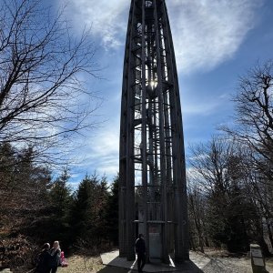
 Rajnochovice: Skiareál Troják - Troják - Maruška - Rozhledna
 Hostalkova: Skiareál Troják - Kamera na svahu B, nástup vleku

| today | tomorrow | day after tomorrow | |
|---|---|---|---|
| Dawn: | 5:57 | 5:59 | 6:00 |
| Sunrise: | 6:30 | 6:32 | 6:33 |
| Sunset: | 16:34 | 16:32 | 16:31 |
| Dusk: | 17:07 | 17:05 | 17:04 |