
Hiking, 11 km
2.5.2026
 Česko
Hlavní město Praha (Hlavní město Praha)
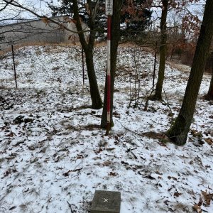
Logged on Vrcholovka 34x in total. Vrchol Havlín was added here by Zdeněk Munzar and info was completed by Zdeněk Munzar.
Havlín is part of challenge: Cross on the Summit of Domestic Mountains and Hills
Havlín, at 268 meters above sea level (according to topographic analysis and the basic map of the Czech Republic, 266 meters according to the Geographic Lexicon of the Czech Republic), is the highest peak of the geomorphological district of Řevnická brázda, a subunit of Hořovická brázda, part of the Hořovická pahorkatina.
At the summit stands the Romanesque church of St. Havl, first mentioned in 1115. The hill is designated as a cultural monument due to the settlement from the 10th-11th centuries. It is often identified with the mountain and fortification of Osek (Osseca), cited by Cosmas. Later, the so-called Kazín is placed here, whose actual location remains undetermined to this day - for example, on Aretin's map of Bohemia from 1619, it is identified with the opposite Hradiště, or the so-called oppidum Závist.
There is no chalet on the peak.
This peak is accessible with a stroller.
There are no views from the peak.
There is no cable car to this peak.
No special equipment is required for this summit.
Peak is freely accessible.
Nearest peaks: Hradiště (389 m, 2 km) Kyjov (254 m, 2.1 km) Na Beránku (364 m, 3 km) Na Zvonici (223 m, 3.6 km)
| today | tomorrow | day after tomorrow | |
|---|---|---|---|
| Dawn: | 7:05 | 6:07 | 6:08 |
| Sunrise: | 7:38 | 6:40 | 6:42 |
| Sunset: | 17:54 | 16:52 | 16:50 |
| Dusk: | 18:27 | 17:25 | 17:23 |