






Hiking, 11 km
20.11.2022
 Rakousko
Logged on Vrcholovka 2x in total. Vrchol Bauleiteck was added here by Martin Malý and info was completed by Martin Matějka a Milan "Hojší" Průžek.
By car (or by bus in season) you can reach the excursion (closed in off-season, otherwise crowded) restaurant by Lake Etrachsee.
From there, we will follow the marked path 794, and after about 1.5 hours, covering approximately 3.5 km and about 300 meters in elevation, we will arrive at the Rudolf-Schober-Hütte where we can refresh ourselves and, if we plan to do more in the area, also stay overnight. In that case, I recommend making a reservation in advance, even for the Winterraum.
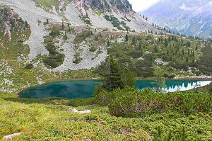
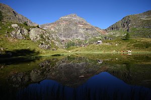
After that, we will head directly uphill behind the hut. At the junction with path 702 to Sankt Nikolai im Sölktal or to the summit Süssleiteck (closed from November 7 to May 15 in the section Bräualm and Dürrmoos Wasserfall for nature protection), we will go slightly left and continue to the lower Wildenkarsee along path 794. Before it, we will turn right. (alternatively, we can take a 5-minute "detour" - in case of the upper one, 50 minutes.) After the turn and climbing to the "high plateau," we will enjoy some flat sections, but only for a brief moment, as we will soon head down the slope to the right. Here we can have a snack and enjoy the first significant views. We have completed the first half of the route from the hut, and ahead of us is the last approximately 1.5 km mostly along the ridge, slightly uphill. After about 2.5 hours from leaving the hut, we will stand at the summit by the cross.
Overall view
Further information can be found:
Bauleiteck in the Schladming Tauern
Schladming Tauern
Main ridge Bauleiteck - Edelfeld
There is no chalet on the peak.
Peak is not stroller accessible.
There are views from the peak.
There is no cable car to this peak.
No special equipment is required for this summit.
Peak is freely accessible.
Nearest peaks: Hasenohren (2325 m, 0.2 km) Krautgartkogel (2329 m, 0.6 km) Gjoadeck (2525 m, 1.3 km) Steinkarspitze (2397 m, 1.3 km) Flederweißspitz (2386 m, 1.5 km) Hinteres Ohreneck (2290 m, 1.5 km) Schimpelspitz (2413 m, 1.5 km) Schönkarlspitze (2349 m, 1.8 km) Schoberspitze (2217 m, 2 km) Dürrnberg (2241 m, 2.1 km) Gross Edelfeld (2335 m, 2.3 km) Süßleiteck (2507 m, 2.3 km) Edelfeld (2314 m, 2.6 km) Vorderes Ohreneck (2154 m, 2.7 km) Mittereck (2469 m, 2.8 km) Steinkarl (2445 m, 3.3 km)
 Přechod Schladmingských Taur
| today | tomorrow | day after tomorrow | |
|---|---|---|---|
| Dawn: | 7:02 | 7:04 | 6:05 |
| Sunrise: | 7:34 | 7:35 | 6:37 |
| Sunset: | 18:02 | 18:01 | 16:59 |
| Dusk: | 18:34 | 18:32 | 17:30 |


