



Via ferrata, 42 km
15.7.2024 to 20.7.2024
 Itálie
Logged on Vrcholovka 1x in total. Vrchol Cima di Val di Roda was added here by Milan "Hojší" Průžek and info was completed by Jan Blažej.
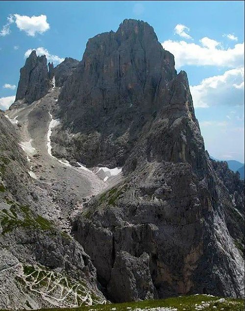
Cima di Val di Roda is a mountain in the Pala group in Italy.
A challenging alpine trail (T5) leads to the summit.
The nearest mountain hut is Rifugio Pradidali, located 1080 m east of the summit.
Difficulty: via ferrata "B" (KS 2):
From the pass, the Sentiero Alpinistico to Forcella "Stephen" starts on the right, whose cable safety equipment was restored by the CAI section of Bassano in 1993. The path runs along the left side of the gorge and is secured with a rope in places on rocky channels and steps. It becomes steeper towards the gap. The gorge narrows. The risk of falling rocks increases as you ascend. You move here without cable protection. After 1 hour from Passo di Ball, you reach Forcella di Stephan (2650 m).
The sign points right over the scree slope to Cima di Val Roda, whose stone pyramid at the summit can be climbed in 20 minutes. It takes another 15 minutes to return to the gap.
The path turns left, has only a few sections secured with a rope, and gently descends over rocks. You reach another gap over a rocky step, from which you descend again into a niche that you cross secured with a rope. After another ascent, you reach another gap (2569 m) in 40 minutes. From here, now in open terrain on unsecured meadows, you go down and up for 30 minutes to descend to Forcella del Porton (2512 m).
The nearest mountain hut is Rifugio Pradidali, located 1,080 m east of the summit.
Peak is not stroller accessible.
There are views from the peak.
There is no cable car to this peak.
No special equipment is required for this summit.
Peak is freely accessible.
Nearest peaks: Cima della Rosetta (2743 m, 1.9 km) Cima della Stanga (2546 m, 2.1 km) Cimerlo (2503 m, 2.5 km)
 Primiero San Martino di Castrozza
 San Martino di Castrozza: Via Passo Rolle
 San Martino di Castrozza: Via Passo Rolle
 San Martino di Castrozza: Via Passo Rolle
 San Martino di Castrozza: Pale San Martino
 San Martino di Castrozza: Pala group
 San Martino di Castrozza: TN) - Prà delle Nasse
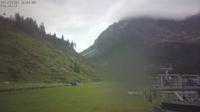 San Martino di Castrozza: Tognola Cima
 San Martino di Castrozza
 Primiero San Martino di Castrozza: Passo Rolle - Impianti Paradiso
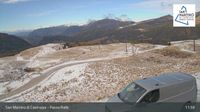
 San Martino di Castrozza: Passo Rolle
| today | tomorrow | day after tomorrow | |
|---|---|---|---|
| Dawn: | 6:19 | 6:21 | 6:22 |
| Sunrise: | 6:50 | 6:52 | 6:53 |
| Sunset: | 17:01 | 17:00 | 16:58 |
| Dusk: | 17:32 | 17:31 | 17:29 |