



Hiking
čt, 5.1.2023, 12:05
 Španělsko
Logged on Vrcholovka 1x in total. Vrchol Caldera de la Laguna was added here by Jiří Králík and info was completed by Martin Matějka.
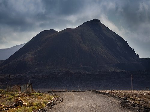
A prominent black volcano from which a lava flow can be seen extending into the ocean when viewed from the summit or an airplane. There used to be a ban on entry due to gravel mining. Mining is no longer taking place, so the gravel road from the former quarry can now be used for access, followed by a well-trodden path on the eastern slope.
There is no chalet on the peak.
Peak is not stroller accessible.
There are views from the peak.
There is no cable car to this peak.
No special equipment is required for this summit.
Peak is freely accessible.
Nearest peaks: Caldera de Liria (227 m, 1 km) Los Morros (183 m, 1.4 km) Roque del Buey (211 m, 2.3 km) Montaña Parrado (256 m, 2.7 km) La Calderita (134 m, 2.8 km) Montaña Negra (201 m, 3 km) Morrito del Asiento (282 m, 3 km) Morro de los Halcones (435 m, 3 km) La Culata (189 m, 3.3 km) La Atalayita (229 m, 3.6 km) Gairia (464 m, 4.1 km)
| today | tomorrow | day after tomorrow | |
|---|---|---|---|
| Dawn: | 6:42 | 6:42 | 6:43 |
| Sunrise: | 7:06 | 7:06 | 7:07 |
| Sunset: | 18:13 | 18:12 | 18:11 |
| Dusk: | 18:37 | 18:36 | 18:35 |