




Hiking
ne, 8.7.2018, 8:30
 Maďarsko
 Rakousko
 Slovinsko
Logged on Vrcholovka 1x in total. Vrchol Dreiländerecke (Hármashatár) was added here by Norbert Mogyorósi and info was completed by Martin Matějka a Šimon Kozel.
A tripoint summit where the borders of Austria, Hungary, and Slovenia meet. It is the westernmost point of Hungary and the westernmost peak of the Vasi-Hegyhát subregion in the Alpokalja region.
There is no chalet on the peak.
This peak is accessible with a stroller.
There are no views from the peak.
There is no cable car to this peak.
No special equipment is required for this summit.
Peak is freely accessible.
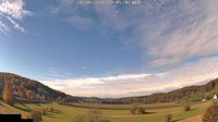
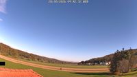 Minihof-Liebau › South-West: Windisch-Minihof
| today | tomorrow | day after tomorrow | |
|---|---|---|---|
| Dawn: | 6:02 | 6:03 | 6:04 |
| Sunrise: | 6:33 | 6:34 | 6:36 |
| Sunset: | 16:45 | 16:43 | 16:41 |
| Dusk: | 17:16 | 17:14 | 17:13 |