
Hornköpfl S (1767 m a.s.l., Kitzbühelské Alpy)

47.46908N, 12.43169E 14 m 21.7.2022 Mapy.cz
Register and log summit
Hornköpfl S
Uploaded: Bouřka

Weather Hornköpfl S

Podpoř Vrcholovku!

About peak Hornköpfl S

Rakousko Rakousko

Logged on Vrcholovka 1x in total. Vrchol Hornköpfl S was added here by Bouřka.

A small bump in the saddle between Kitzbüheler Horn and Hornköpfl. A path runs directly over the top.

Chalet/accommodation

There is no chalet on the peak.

Stroller access

Peak is not stroller accessible.

Views

There are views from the peak.

Cable car

There is no cable car to this peak.

Equipment

No special equipment is required for this summit.

Accessibility

Peak is freely accessible.

Nearest peaks: Hornköpfl (1773 m,  0.3 km) Über der Weg (1724 m,  0.6 km) Kitzbüheler Horn (1996 m,  0.8 km) Harschbichl (1604 m,  1.7 km)

Routes nearby

Routes provided by SvetOutdooru.cz

Webcams

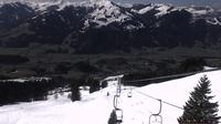
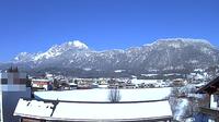
Stadt Kitzbuhel: Kitzbühel - Speicherteich Hornköpfl
( 0.3 km)
Stadt Kitzbuhel: Kitzbühel - Speicherteich Hornköpfl
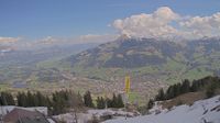
Stadt Kitzbuhel: Hornköpflhütte
( 0.3 km)
Stadt Kitzbuhel: Hornköpflhütte
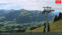
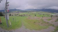
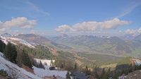
Griesenau: Kitzbüheler Horn
(1646 m a.s.l.,  0.3 km)
Griesenau: Kitzbüheler Horn
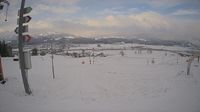
Stadt Kitzbuhel: Kitzbüheler Horn
( 0.7 km)
Stadt Kitzbuhel: Kitzbüheler Horn
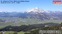
Marktgemeinde St. Johann in Tirol: St. Johann in
( 1.8 km)
Marktgemeinde St. Johann in Tirol: St. Johann in
Aurach am Hongar: Kitzbühel - Bichlalm
( 3.5 km)
Aurach am Hongar: Kitzbühel - Bichlalm
Stadt Kitzbuhel: Bichlalm
(1563 m a.s.l.,  3.5 km)
Stadt Kitzbuhel: Bichlalm
Gemeinde Oberndorf in Tirol: Sankt Johann
( 3.7 km)
Gemeinde Oberndorf in Tirol: Sankt Johann
St. Johann in Tirol: Sankt Johann in
( 3.7 km)
St. Johann in Tirol: Sankt Johann in
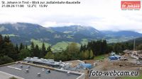
Marktgemeinde St. Johann in Tirol: St. Johann in Tirol - Blick zur Jodlalmbahn-Baustelle
( 3.8 km)
Marktgemeinde St. Johann in Tirol: St. Johann in Tirol - Blick zur Jodlalmbahn-Baustelle
Stadt Kitzbuhel: Kitzbühel - Schloss Lebenberg
(819 m a.s.l.,  4.1 km)
Stadt Kitzbuhel: Kitzbühel - Schloss Lebenberg
Stadt Kitzbuhel: Kitzbühel - Schmalegg
( 4.4 km)
Stadt Kitzbuhel: Kitzbühel - Schmalegg
Stadt Kitzbuhel: Kitzbühel - Zielhaus Hahnenkamm - Blick nach Osten in die Südberge
( 4.6 km)
Stadt Kitzbuhel: Kitzbühel - Zielhaus Hahnenkamm - Blick nach Osten in die Südberge
Oberndorf in Tirol: Blick aufs Kitzbüheler Horn vom Gartenhotel Rosenhof
(722 m a.s.l.,  4.9 km)
Oberndorf in Tirol: Blick aufs Kitzbüheler Horn vom Gartenhotel Rosenhof
Sankt Johann in Tirol › North-West: Wilder Kaiser
(680 m a.s.l.,  5.3 km)
Sankt Johann in Tirol › North-West: Wilder Kaiser
Sankt Johann in Tirol › South: Kitzbüheler Horn
(654 m a.s.l.,  6.1 km)
Sankt Johann in Tirol › South: Kitzbüheler Horn
St. Johann in Tirol: Kitzbüheler Horn
(660 m a.s.l.,  6.1 km)
St. Johann in Tirol: Kitzbüheler Horn
St. Johann in Tirol: Wilder Kaiser
(659 m a.s.l.,  6.1 km)
St. Johann in Tirol: Wilder Kaiser
Kitzbuhel: Hahnenkamm Bergstation - Blickrichtung NO
(1630 m a.s.l.,  6.4 km)
Kitzbuhel: Hahnenkamm Bergstation - Blickrichtung NO
Stadt Kitzbuhel: Kitzbühel - Hahnenkamm Bergstation - Blickrichtung NO
( 6.4 km)
Stadt Kitzbuhel: Kitzbühel - Hahnenkamm Bergstation - Blickrichtung NO
Högl: Kitzbühel − Hahnenkamm
(1606 m a.s.l.,  6.4 km)
Högl: Kitzbühel − Hahnenkamm
Stadt Kitzbuhel: Kitzbühel - Hahnenkamm Bergstation - Blickrichtung NW
( 6.4 km)
Stadt Kitzbuhel: Kitzbühel - Hahnenkamm Bergstation - Blickrichtung NW
Kitzbuhel: Hahnenkamm Bergstation - Blickrichtung NW
(1650 m a.s.l.,  6.4 km)
Kitzbuhel: Hahnenkamm Bergstation - Blickrichtung NW
Gemeinde Going am Wilden Kaiser: St. Johann in - Blick zum Wilden Kaiser
(1308 m a.s.l.,  7.6 km)
Gemeinde Going am Wilden Kaiser: St. Johann in - Blick zum Wilden Kaiser
Cameras provided by windy.com

Sun

today tomorrow day after tomorrow
Dawn: 6:17 6:19 6:20
Sunrise: 6:49 6:50 6:52
Sunset: 16:58 16:56 16:55
Dusk: 17:30 17:28 17:27

Latest summits

Bouřka on the summit of Hornköpfl S (21.7.2022 7:38)
Bouřka
Hiking
čt, 21.7.2022, 7:38

Share