

Hiking, 30 km
12.9.2026
 Česko
Prachatice (Jihočeský kraj)
Logged on Vrcholovka 12x in total. Vrchol Buková slať J was added here by Bouřka and info was completed by Bouřka a Martin Matějka.
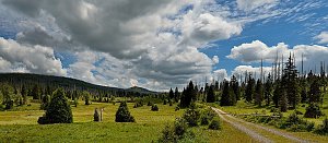
A flat summit near a marked trail, the highest point is very difficult to identify. Accessibility is easy, just a short detour through the forest from the trail. It is not listed in the official lists on tisicovky.cz, but it meets the criteria for a secondary peak due to its prominence.
There is no chalet on the peak.
Peak is not stroller accessible.
There are no views from the peak.
There is no cable car to this peak.
No special equipment is required for this summit.
Peak is freely accessible.
Nearest peaks: Buková slať (1003 m, 0.6 km) Knížecí pláně JV (1004 m, 0.7 km) Žďárecká slať (993 m, 0.8 km) Knížecí pláně (1025 m, 1.1 km) Jelení slať S (1046 m, 1.3 km) Knížecí pláně - U kostela (1026 m, 1.6 km) Nad Bukovou slatí (1027 m, 1.6 km) Reifenspitz (1044 m, 1.7 km) Jelení slať J (1030 m, 1.8 km) Jelení hora Z (1035 m, 2.2 km) Nad Poleckou nádrží (999 m, 2.2 km) Polední vrch (1054 m, 2.2 km) Pomezní vrch (1068 m, 2.4 km) On the Slope (1008 m, 2.6 km) Stodůlecká hora (1062 m, 2.6 km) Homole (1045 m, 3.2 km) Southwest Viewpoint (1057 m, 3.3 km) Žďárecká hora (1064 m, 3.3 km)
 Strážný › South: Dreisesselberg − Plöckenstein
 Strazny
 Kvilda: Obec - Chalupa Ve Stráni
 Strazny › North
 Kvilda
 Kvilda: I, POI 1
 Kvilda
 Kvilda: Horská
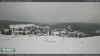 Kvilda: Jezerní potok (pohled směr Horská)
 Nové Hutě: Vlek U lesa
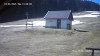 Nove Hute › West

| today | tomorrow | day after tomorrow | |
|---|---|---|---|
| Dawn: | 6:18 | 6:19 | 6:21 |
| Sunrise: | 6:50 | 6:52 | 6:54 |
| Sunset: | 16:47 | 16:45 | 16:43 |
| Dusk: | 17:20 | 17:18 | 17:16 |