


Hiking
út, 22.8.2023, 11:02
 Itálie
Logged on Vrcholovka 6x in total. Peak information here was completed by Martin Matějka, Bouřka a Jan Blažej.
Antelao is part of challenges: Ultraprominent Europe, Vápencové ultraperly východních Alp
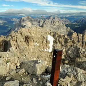
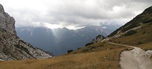
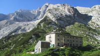
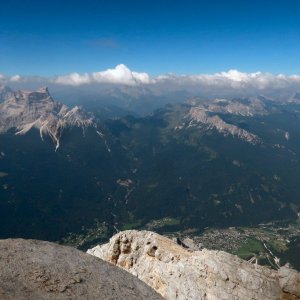
The second highest mountain in the Dolomites and the highest peak of the eastern (Cadore) Dolomites. An enormous rock pyramid southwest of Cortina above the village of San Vito di Cadore, which is also the standard starting point for the ascent via the normal route, whose crucial upper section leads from the north side. The ascent is completely easy to the Forcella Piccola saddle (2120 m), above which the terrain gradually becomes more challenging. One must first contend with a massive scree basin, which the path skirts from the left, followed by a steep and unpleasant loose scree slope. This is followed by a climb up the wall on ledges (UIAA I, exposed), to a flat ridge, where initially there is about a 20 m traverse along a crack on an otherwise quite smooth slab, then relatively easy rocky terrain upwards (one spot I). Then at about 2800 m begins what characterizes the normal route - a smooth slab with a slope of 35-40°, without major holds or steps. Generally, it is good to keep to the left, where there are (especially in the higher sections) indications of a path in occasional scree. Even above the slab, the climb is not yet won; one must navigate around rock towers and the route is not always entirely clear (some sections I-II, again quite exposed), however, the summit is already within reach. It is definitely recommended for regular high-altitude hikers to have stable weather and to be free of a fear of heights, as the ascent route offers only a few securing points (a piece of rope in the upper part of the slab and a few bolts), and I would not want to descend the slab in changing weather, although there are certainly those who can run down it like a squirrel. The entire ascent can be completed in one day from the parking lot at the ski slope, but it is 2200 m up and down again; it may be more advantageous to use overnight accommodation either at the Scotter-Pallatini hut (1570 m) or Pietro Galassi (2020 m). In summary - a somewhat difficult, but very beautiful peak that is worth the effort!
One at an altitude of 1570 m, the other at an altitude of 2020 m.
Peak is not stroller accessible.
There are views from the peak.
There is no cable car to this peak.
No special equipment is required for this summit.
Peak is freely accessible.
Nearest peaks: Forcella Piccola (2292 m, 1.7 km) Becchi d'Improsponda (2087 m, 2.2 km) Cime Scotter (2716 m, 2.7 km)
| today | tomorrow | day after tomorrow | |
|---|---|---|---|
| Dawn: | 7:08 | 7:10 | 6:11 |
| Sunrise: | 7:39 | 7:40 | 6:42 |
| Sunset: | 18:11 | 18:09 | 17:07 |
| Dusk: | 18:41 | 18:40 | 17:38 |