



Hiking, 8 km
31.8.2024
 Česko
Klatovy (Plzeňský kraj)
Logged on Vrcholovka 7x in total. Vrchol Slavník was added here by Bouřka and info was completed by Krtek.
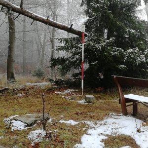
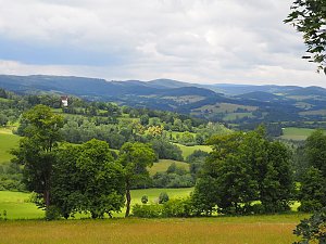
Rising above the surroundings in the vast Blatenská Highlands is the mountain Slavník (627 m.a.s.l.). It emerges from the rolling plain that stretches in the valley of the Otava River from Horažďovice to the Budětice Highlands. Slavník holds the same significance for this region as Říp does for the entire country. Its sacredness has roots in ancient history, and it is no coincidence that one of the many rock formations is called 'Pagan Table.' According to some historians, the boundary of the Slavník estate may have passed through here. The writer Ladislav Stehlík mentions Slavník in 'Země zamyšlené.' Moreover, the mountain is visible from many places above the Otava valley. (turistika.cz)
Extensive forested areas are interspersed with clearings, providing limited views from the summit.
There is no chalet on the peak.
Peak is not stroller accessible.
Partial views.
There is no cable car to this peak.
No special equipment is required for this summit.
Peak is freely accessible.
Nearest peaks: Slavník S (614 m, 0.2 km) Slavník J (593 m, 0.4 km) Slavník SZ (596 m, 0.5 km) Slavník S2 (607 m, 0.6 km) Slavník J2 (559 m, 0.7 km) Slavník SZ2 (590 m, 0.7 km) Slavník V (595 m, 0.8 km) Slavník J3 (536 m, 0.9 km) Slavník JJV (545 m, 1 km) Soudná (575 m, 1.1 km) Břežany (518 m, 1.3 km) Nad Pasečnou (609 m, 1.3 km) Za Kostelem (585 m, 1.3 km) Břežany JV (516 m, 1.6 km) Above Velešický Pond (520 m, 1.9 km) Telecí vrch (542 m, 1.9 km) K Radině (484 m, 2.1 km) Trávníky (562 m, 2.1 km) Na kotalkách (581 m, 2.2 km) Na Slatině (491 m, 2.3 km) Kozí vršek (469 m, 2.5 km) On the Peaks (485 m, 2.6 km) Bílovky (490 m, 3 km) Radina JJZ (484 m, 3 km) Plesník (605 m, 3.1 km)
| today | tomorrow | day after tomorrow | |
|---|---|---|---|
| Dawn: | 7:06 | 7:08 | 6:09 |
| Sunrise: | 7:39 | 7:40 | 6:42 |
| Sunset: | 18:00 | 17:58 | 16:56 |
| Dusk: | 18:33 | 18:31 | 17:29 |